

Why
do they always have to LIE?!
El
Niño likely setting up for a winter comeback
10
August, 2018
Friday,
August 10, 2018, 5:03 PM - A winter return for El Niño? It's been a
few years since one reared its ugly head, but from what forecasters
are seeing in and above the Pacific Ocean, there's a good chance El
Niño will be back for this coming winter.
Based
on the latest update from forecasters with NOAA's Climate Prediction
Center, dated August 9, there is now at
least a 60 per cent chance that
El Niño conditions will develop in the equatorial Pacific during the
autumn months (September through December), and over
a 70 per cent chance they
will develop by winter (November through February).

This
graph shows the collected computer model runs - dynamical and
statistical - for the upcoming three-month periods. Bold lines
indicate the model run averages, and the forecaster consensus.
Credit: IRI/CPC
Forecasts
are issued on a monthly basis, so this may change - going weaker or
stronger - so watch for any updates to come.
WHAT IS EL NIÑO?
El
Niño, the warm phase of the El Niño-Southern Oscillation (ENSO), is
a regular climate pattern that develops along and above the
equatorial Pacific Ocean.
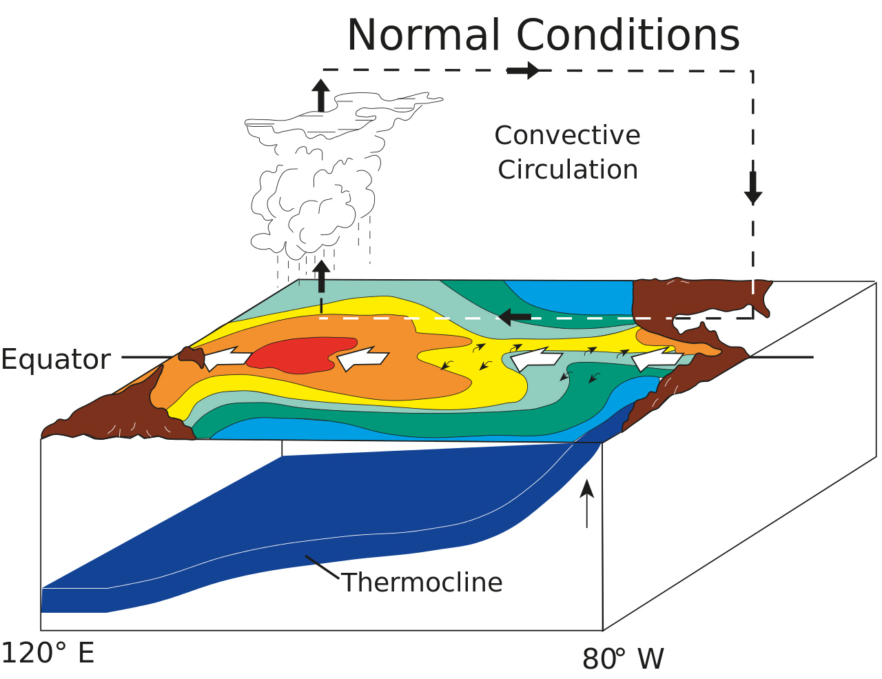
Normally,
conditions in that part of the world see strong trade winds, blowing
east to west, which push warm surface waters along with them, causing
them to 'pile up' around Indonesia and northern Australia.
Periodically, these trade winds weaken, and the whole system
'relaxes', allowing those warm waters to slosh back towards the
central and eastern equatorial Pacific. This arrival of warm waters
off the coast of Ecuador and Peru typically happened in late
December, and thus the pattern was named El Niño, or The Child, in
reference to Christmas.
This occurs roughly every three to five years, and individual El Niño events are separated by periods of normal (or 'neutral') conditions, or by cold La Niña patterns, which have a similar pattern to the normal conditions (warm in the western central Pacific and cool in the east), but ramped up to more of an extreme.
This occurs roughly every three to five years, and individual El Niño events are separated by periods of normal (or 'neutral') conditions, or by cold La Niña patterns, which have a similar pattern to the normal conditions (warm in the western central Pacific and cool in the east), but ramped up to more of an extreme.
 |
 |
| Typical
ENSO-neutral (left) and El Niño (right) conditions over the
Pacific Ocean. Credit: NOAA |
|
When
an El Niño develops, all that warm water sloshing back towards the
east changes the weather patterns over wide regions of the planet.
Typically, it means a warmer winter for parts of Canada, as the added
heat shifts weather patterns over and around North America further
north and east for the duration of the event.
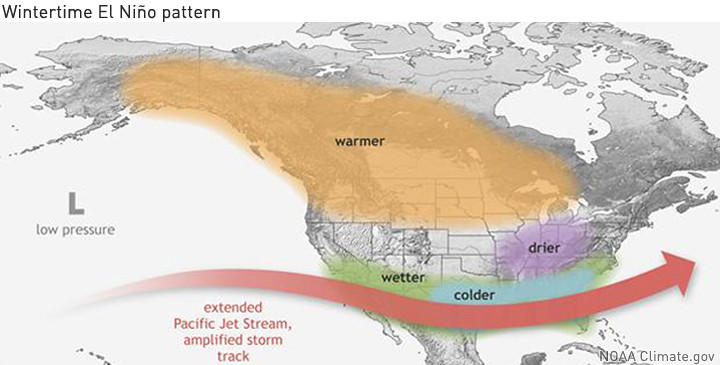
The typical effects of an El Nino on wintertime across North America. Credit: Climate.gov
The
effects of each El Niño are different, however, as stronger or
weaker patterns have a greater or lesser impact on the weather, and
other large climate patterns (such as the North Atlantic Oscillation)
exert their own influences.
RELATED:
NASA COMPARES THE 2015-16 EL NINO TO THE SUPER EL NINO OF 1997-98.
No comments:
Post a Comment
Note: only a member of this blog may post a comment.