

Unexpected
surge of water vapor in the mesosphere, prolonged noctilucent clouds
season

16
August, 2018
During
the first half of August 2018, reports of noctilucent clouds to
Spaceweather.com have tripled compared to the same period
in 2017 and researchers at the University of Colorado may have
figured out why.
"There
has been an unexpected surge of water vapor in the mesosphere,"
Lynn Harvey of Colorado's Laboratory for Atmospheric and Space
Physics (LASP) said.
This
plot, which Harvey prepared using data from NASA's satellite-based
Microwave Limb Sounder (MLS) instrument, shows that the days of late
July and August 2018 have been the wettest in the mesosphere for the
past 11 years:

Image
credit: LASP via SpaceWeather.com
In
addition to being extra wet, the mesosphere has also been a bit
colder than usual, Dr. Tony Phillips of the SpaceWeather.com reports.
The combination of wet and cold has created favorable conditions for
icy noctilucent clouds.
Harvey
and her colleagues are still working to understand how the extra
water got up there, Phillips continues. "One possibility
involves planetary wave activity in the southern hemisphere
which can, ironically, boost the upwelling of water vapor tens of
thousands of miles away in the north, but the phenomenon could also
be linked to solar minimum, now underway."
"It
is notable that the coldest and wettest years in the mesosphere prior
to 2018 were 2008 - 2009, the previous minimum of the 11-year solar
cycle," Phillips concludes.
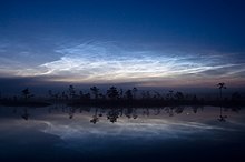
Featured
image: Taken by Rauno Pakarinen on August 1, 2018 @ The
Tahinlampi Pond, Pieksämäki via SpaceWeather.com
***
From
Wikipedia...
Noctilucent
cloud
Noctilucent
clouds, or night shining clouds, are tenuous cloud-like phenomena in
the upper atmosphere of Earth. They consist of ice crystals and are
only visible during astronomical twilight. Noctilucent roughly means
"night shining" in Latin. They are most often observed
during the summer months from latitudes between 50° and 70° north
and south of the Equator. They are visible only during local summer
months and when the Sun is below the observer's horizon, but while
the clouds are still in sunlight. Recent studies suggests that
increased atmospheric methane emissions produce additional water
vapor once the methane molecules reach the mesosphere - creating, or
reinforcing existing noctilucent clouds.[1]
They
are the highest clouds in Earth's atmosphere, located in the
mesosphere at altitudes of around 76 to 85 km (47 to 53 mi). They are
too faint to be seen in daylight, and are visible only when
illuminated by sunlight from below the horizon while the lower layers
of the atmosphere are in Earth's shadow.
Noctilucent
clouds are not fully understood and are a recently discovered
meteorological phenomenon. No confirmed record of their observation
exists before 1885, although they may have been observed a few
decades earlier by Thomas Romney Robinson in Armagh.[2] Doubts now
surround Robinson's out-of-season records, following observations,
from several points around high northern latitudes, of NLC-like
phenomena following the Chelyabinsk superbolide entry in February
2013 (outside the NLC season) that were in fact stratospheric dust
reflections visible after sunset.
Noctilucent
clouds can form only under very restricted conditions during local
summer; their occurrence can be used as a sensitive guide to changes
in the upper atmosphere. They are a relatively recent classification.
The occurrence of noctilucent clouds appears to be increasing in
frequency, brightness and extent.
Just
in case you get the “wrong” idea the BBC TELLS you what they are.
P { margin-bottom: 0.21cm; }
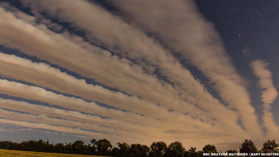
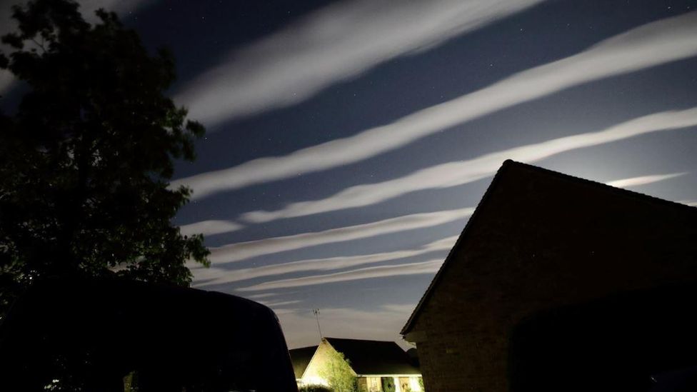
Unusual
'cloud streets' spotted over Oxfordshire and Gloucestershire
U.S.
gasoline demand down almost 0.7 mln bpd in 5 yrs
BBC,
24
August, 2018
Spectacular
cloud formations known as 'cloud streets' have been spotted in
southern England.
The
long streaks of cloud were seen by BBC Weather Watchers in
Oxfordshire and Gloucestershire on Thursday evening.
BBC
weather presenter Simon King said the clouds are not uncommon in the
UK but these stood out against the fading light of the sky.
"Cloud
streets are essentially long rows of cumulus cloud aligned in the sky
with the wind direction," he said.
"
"
 I
I
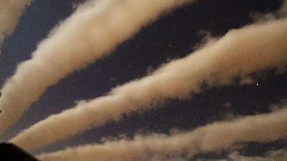
BBC
Weather presenter Simon King explains how 'cloud streets' form
Warm
air on the surface rises, cools and condenses into cloud.
In
certain situations a warm layer of air in the lower atmosphere,
called an inversion, acts as a lid preventing air from rising any
further.
This
means at the top of the cloud, the cooler air is forced out
horizontally where it will then start to sink back to Earth.
In
this area, cloud doesn't form, so it is clear. This all sets up a
cylindrical circulation which is parallel with the wind, creating the
long row of cloud.
No comments:
Post a Comment
Note: only a member of this blog may post a comment.