Hurricane Maria "Models" Showing N. Carolina Impact - Concerns for NC to NYC
New
computer forecast models for Hurricane Maria which violently struck
Puerto Rico, are raising concerns about a North Carolina Landfall,
and for serious effects from North Carolina to New York City,
especially along the NEW JERSEY Shore.
According
to the National Hurricane Center, Maria's projected course has taken
a more westerly shift; likely causing actual LANDFALL in the Outer
Banks of North Carolina, then skimming up the coast toward Chesapeake
Bay, the slightly out to sea along the New Jersey coast and turning
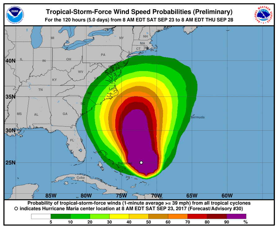
east into the ocean near New York City. Below is the latest "cone
of uncertainty:

Here
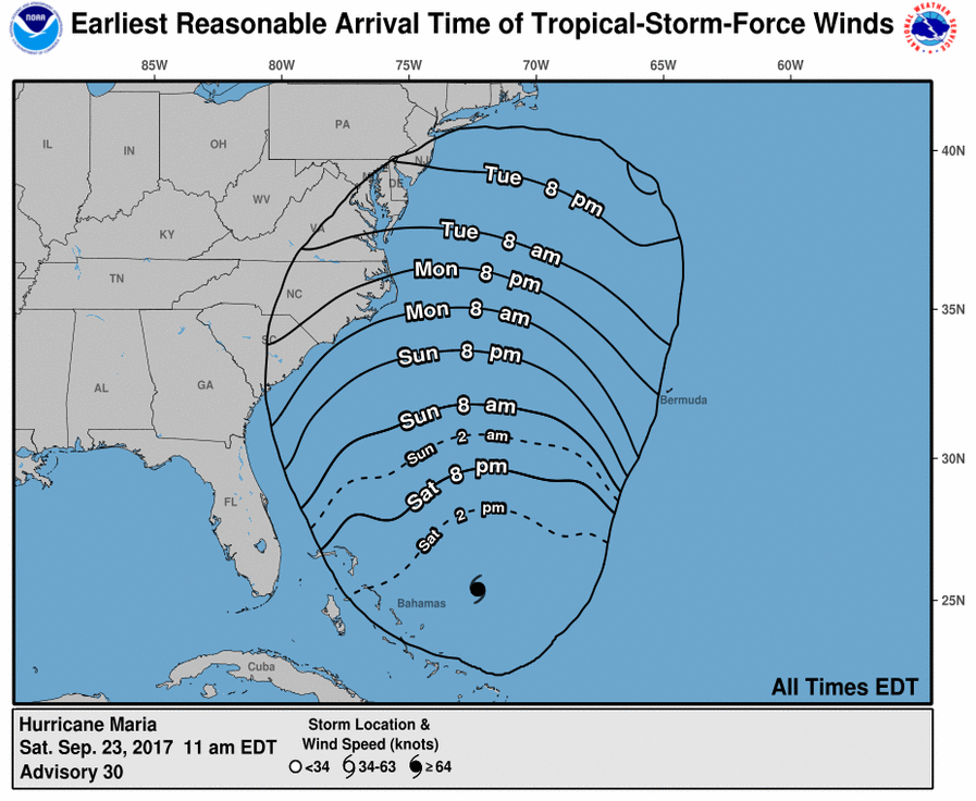
is the TIME SCHEDULE which is now being forecast: Less than TWO DAYS
until impact along the US East Coast!

Maria
is still a Category 3 hurricane, and, to be blunt, she's a big,
vicious bitch, too! Here's a satellite photo from September 23
at about 1:00 PM eastern US time:

Sometimes
satellite photos from 22,000 miles away cannot truly convey how
massive such storms are, but these photos from an Astronaut aboard
the International Space Station which is only about 110 miles away,
show this storm as the beast it truly is:
Take
a look at the computer forecast models in the image below:
COMPUTER
MODELS CAN BE WRONG. Prudence dictates that folks in North
Carolina, Virginia, eastern Maryland, Delaware, New Jersey and the
five boroughs of New York City, pay VERY CLOSE ATTENTION to the track
of this storm and begin making initial preparations for severe
weather.
Don't
make the same mistakes that people in Houston and Florida made. A
lot of them waited until a day before the storm actually struck, to
try to get emergency supplies. Many of those people found
themselves staring at EMPTY SUPERMARKET SHELVES and EMPTY GAS
STATIONS. Don't be like them; start preparing right now.
Based
on the time schedule shown above, coastal areas along the US East
Coast are less than 72 hours away from the effects of Hurricane
Maria. Prepare NOW!


No comments:
Post a Comment
Note: only a member of this blog may post a comment.