337
Rivers are FLOODING
Thornews
URGENT:
FLOODING ALREADY COMMENCING FROM STORM SURGE IN FLORIDA; STORM STILL
300 MILES AWAY ! ! !

9
October, 2018
Monster
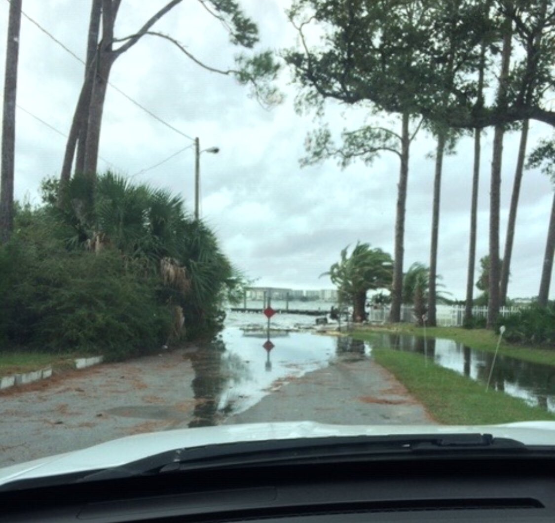
Hurricane Michael is already causing land flooding in the Florida
Panhandle despite being more than three
hundred MILES away from
landfall.
According
to the Okaloosa County Sheriff's Department, as of 8:21 this morning,
water has begun coming ashore in Shalimar, Florida, near Destin and
Fort Walton Beach! Worse, this is taking place despite this
area being protected by offshore barrier islands!
National
Hurricane Center forecasters are now warning that "wave
heights as the storm comes ashore will reach or exceed forty feet!"
Here
is the official projection map from the National Hurricane Center
showing FORTY FOOT wave around the eyewall as Michael comes ashore:

Warnings
of STORM SURGE have already gone up, with the MINIMUM showing NINE
FEET of water above normal high tide covering land:

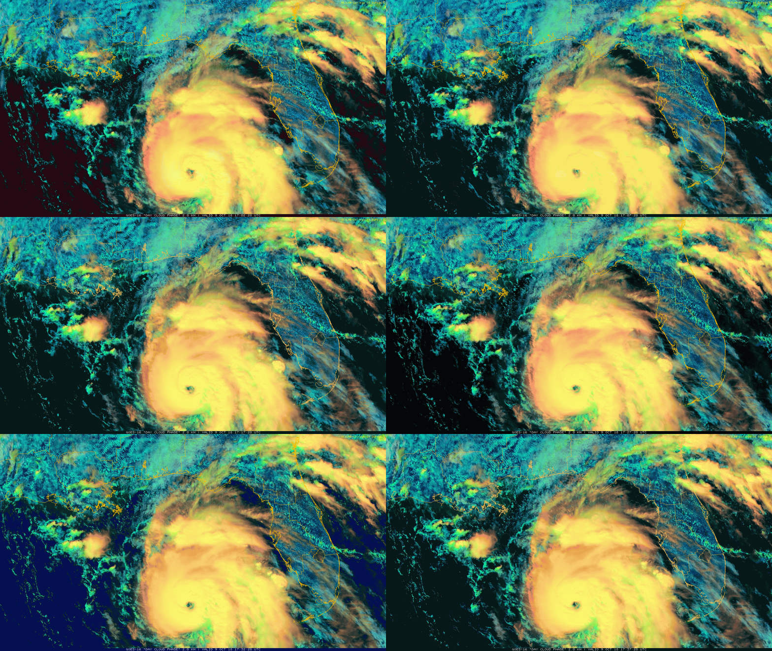
Here is a satellite view of Hurricane Michael as of about 1:00 PM EDT Tuesday afternoon:

The
official National Hurricane Center interim report as of 2:00 PM
eastern daylight time Tuesday:
000
WTNT34 KNHC 091741
TCPAT4

BULLETIN
Hurricane Michael Intermediate Advisory Number 12A
NWS National Hurricane Center Miami FL       AL142018
100 PM CDT Tue Oct 09 2018

...EYE OF DANGEROUS HURRICANE MICHAEL MOVING NORTHWARD OVER THE
EASTERN GULF OF MEXICO...
...LIFE-THREATENING STORM SURGE...HURRICANE FORCE WINDS...AND HEAVY
RAINFALL EXPECTED ALONG THE NORTHEASTERN GULF COAST...


SUMMARY OF 100 PM CDT...1800 UTC...INFORMATION
----------------------------------------------
LOCATION...25.4N 86.4W
ABOUT 335 MI...540 KM S OF PANAMA CITY FLORIDA
ABOUT 310 MI...500 KM SSW OF APALACHICOLA FLORIDA
MAXIMUM SUSTAINED WINDS...110 MPH...175 KM/H
PRESENT MOVEMENT...N OR 350 DEGREES AT 12 MPH...19 KM/H
MINIMUM CENTRAL PRESSURE...965 MB...28.50 INCHES


WATCHES AND WARNINGS
--------------------
CHANGES WITH THIS ADVISORY:

None

SUMMARY OF WATCHES AND WARNINGS IN EFFECT:

A Storm Surge Warning is in effect for...
* Okaloosa/Walton County Line Florida to Anclote River Florida

A Storm Surge Watch is in effect for...
* Anclote River Florida to Anna Maria Island Florida, including
Tampa Bay
* Alabama/Florida border to Okaloosa/Walton County Line Florida

A Hurricane Warning is in effect for...
* Alabama/Florida border to Suwannee River Florida

A Tropical Storm Warning is in effect for...
* Alabama/Florida border to the Mississippi/Alabama border
* Suwanee River Florida to Chassahowitzka Florida

A Tropical Storm Watch is in effect for...
* Chassahowitzka to Anna Maria Island Florida, including Tampa Bay
* Mississippi/Alabama border to the Mouth of the Pearl River
* Fernandina Beach Florida to South Santee River South Carolina

A Storm Surge Warning means there is a danger of life-threatening
inundation, from rising water moving inland from the coastline,
during the next 36 hours in the indicated locations. For a depiction
of areas at risk, please see the National Weather Service Storm
Surge Watch/Warning Graphic, available at hurricanes.gov.  This is a
life-threatening situation.  Persons located within these areas
should take all necessary actions to protect life and property from
rising water and the potential for other dangerous conditions.
Promptly follow evacuation and other instructions from local
officials.

A Hurricane Warning means that hurricane conditions are expected
somewhere within the warning area, in this case within the next
24 hours.  Preparations to protect life and property should be
rushed to completion.

A Tropical Storm Warning means that tropical storm conditions are
expected somewhere within the warning area, in this case within the
next 12 to 24 hours.

A Storm Surge Watch means there is a possibility of life-
threatening inundation, from rising water moving inland from the
coastline.

A Tropical Storm Watch means that tropical storm conditions are
possible within the watch area.

Interests elsewhere across the southeastern United States should
monitor the progress of Michael.

For storm information specific to your area, including possible
inland watches and warnings, please monitor products issued by your
local National Weather Service forecast office.


DISCUSSION AND OUTLOOK
----------------------
At 100 PM CDT (1800 UTC), the eye of Hurricane Michael was located
near latitude 25.4 North, longitude 86.4 West. Michael is moving
toward the north near 12 mph (19 km/h).  A northward motion is
expected through tonight, followed by a northeastward motion on
Wednesday and Thursday.  On the forecast track, the center of
Michael will move across the eastern Gulf of Mexico through tonight.
The center of Michael is then expected to move inland over the
Florida Panhandle or Florida Big Bend area on Wednesday, and then
move northeastward across the southeastern United States Wednesday
night and Thursday, and move off the Mid-Atlantic coast away from
the United States by Friday.

Data from an Air Force Reserve Hurricane Hunter aircraft indicate
that the maximum sustained winds are near 110 mph (175 km/h) with
higher gusts. Additional strengthening is expected, and Michael is
forecast to be a major hurricane at landfall in Florida. Weakening
is expected after landfall as Michael moves through the southeastern
United States.

Hurricane-force winds extend outward up to 35 miles (55 km) from
the center and tropical-storm-force winds extend outward up to 185
miles (295 km). NOAA buoy 42003 recently reported 1-minute mean
winds of 54 mph (87 km/h) and a wind gust of 59 mph (94 km/h).

The latest minimum central pressure based on data from the aircraft
is 965 mb (28.50 inches).


HAZARDS AFFECTING LAND
----------------------
STORM SURGE:  The combination of a dangerous storm surge and the
tide will cause normally dry areas near the coast to be flooded by
rising waters moving inland from the shoreline. The water has the
potential to reach the following heights above ground if peak surge
occurs at the time of high tide...

Indian Pass FL to Cedar Key FL...8-12 ft
Cedar Key FL to Crystal River FL...6-8 ft
Okaloosa/Walton County Line FL to Indian Pass FL...6-9 ft
Crystal River FL to Aripeka FL...4-6 ft
Aripeka FL to Anna Maria Island FL including Tampa Bay...2-4 ft
Alabama/Florida border to Okaloosa/Walton County Line FL...2-4 ft

WIND:  Hurricane conditions are expected within the hurricane
warning area along the U.S. Gulf Coast by Wednesday, with tropical
storm conditions expected by tonight or early Wednesday.  Hurricane
conditions will also spread well inland across portions of the
Florida Panhandle, southeastern Alabama and southwestern Georgia.

Tropical storm conditions are expected in the tropical storm warning
area by tonight or early Wednesday, and are possible within the
tropical storm watch area by that time.  Hurricane conditions are
possible within the hurricane watch area by Wednesday.

Tropical storm conditions are possible in the watch area along the
southeast U.S. coast Wednesday night and Thursday.

RAINFALL:  Michael is expected to produce the following rainfall
amounts through Friday...

Western Cuba...4 to 8 inches, with isolated maximum amounts of 12
inches. This rainfall could lead to life-threatening flash floods
and mudslides.

Florida Panhandle and Big Bend, southeast Alabama, and southern
Georgia...4 to 8 inches, with isolated maximum amounts of 12 inches.
This rainfall could lead to life threatening flash floods.

Eastern Georgia, the Carolinas, and southern Virginia...3 to 6
inches. This rainfall could lead to life-threatening flash floods.

Florida Peninsula, eastern Mid Atlantic, southern New England
coast...1-3 inches.

SURF:  Swells generated by Michael are affecting the coasts of the
eastern and northern Gulf of Mexico, and will spread to portions of
the northwestern and western Gulf of Mexico coast during the next
day or so.  These swells are likely to cause life-threatening surf
and rip current conditions.  Please consult products from your local
weather office.

TORNADOES:  The threat for tornadoes will increase late tonight into
Wednesday over parts of the Florida Panhandle, the northern Florida
Peninsula, and southern Georgia.


NEXT ADVISORY
-------------
Next complete advisory at 400 PM CDT.

$$
Forecaster Brown
UPDATE
3:58 PM EDT --
The
storm is already pushing so much water in the entire Gulf of Mexico,
that Tidal Surge has already begun to flood Sanibel, FL. Video from
Tuesday afternoon, below:
Category
5 Hurricane Michael is Possible
22
more hours to develop, no wind shear, no dry air & Wilma went
from TS to Cat 5 in 54 Hours, It is within the realm of possibilities
that Michael can go from Car 3 to cat 5 in 22 hours. God bless
everyone, T
For
an authorised view see this


No comments:
Post a Comment
Note: only a member of this blog may post a comment.