Atlantic Tropical Storm Bonnie May Become Second 2016 Cyclone to Form Before Hurricane Season Start
26
May, 2016
Ocean
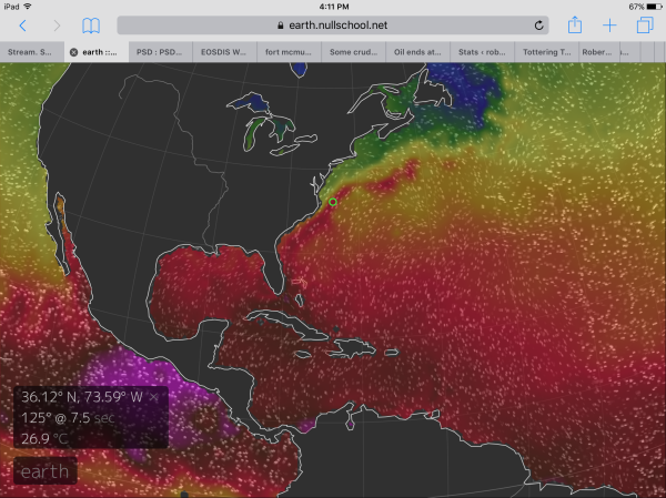
temperatures off the East Coast of the US are extraordinarily warm
for this time of year. A region of water in the Gulf Stream 100 miles
off Virginia Beach now features sea surface temperatures of 81
degrees Fahrenheit or 10 degrees (F) above average. To the south and
east, in a stormy zone between Bermuda and the Bahamas, temperatures
are around 77 degrees Fahrenheit or 4 degrees above average. Readings
more typical of July and not at all usual for May in this region of
the world ocean.
(Extremely
warm sea surface temperatures ranging from 75 to 82 Fahrenheit off
the US East Coast contain enough heat potential energy to support
tropical storm and hurricane development during late May. Image
source: Earth
Nullschool.)
Ocean
heat is a primary driver of tropical cyclone formation. And record
warm 2016 land and ocean surfaces contributed to the
January formation of hurricane Alex in the Northeastern Atlantic this
year.
An unprecedented January-forming hurricane that organized five months
before the typical start of hurricane season on June 1. Now, a
low pressure center swirling between the Bahamas and Bermuda on
Thursday appears to be developing tropical or subtropical
characteristics in what may become Bonnie — the second named
tropical cyclone of 2016 — over the next few days.
Weather
statements from the National Hurricane Center (NHC) at 2:55 PM
Eastern Standard Time noted that conditions would become more
favorable for tropical cyclone development over the next 24-48 hours.
And the Center predicted that a tropical cyclone was 60 percent
likely to form over the next two days and 70 percent likely to form
over the coming five. The NHC also warned that all coastal interests
from Georgia to North Carolina should monitor the progress of this
developing low.
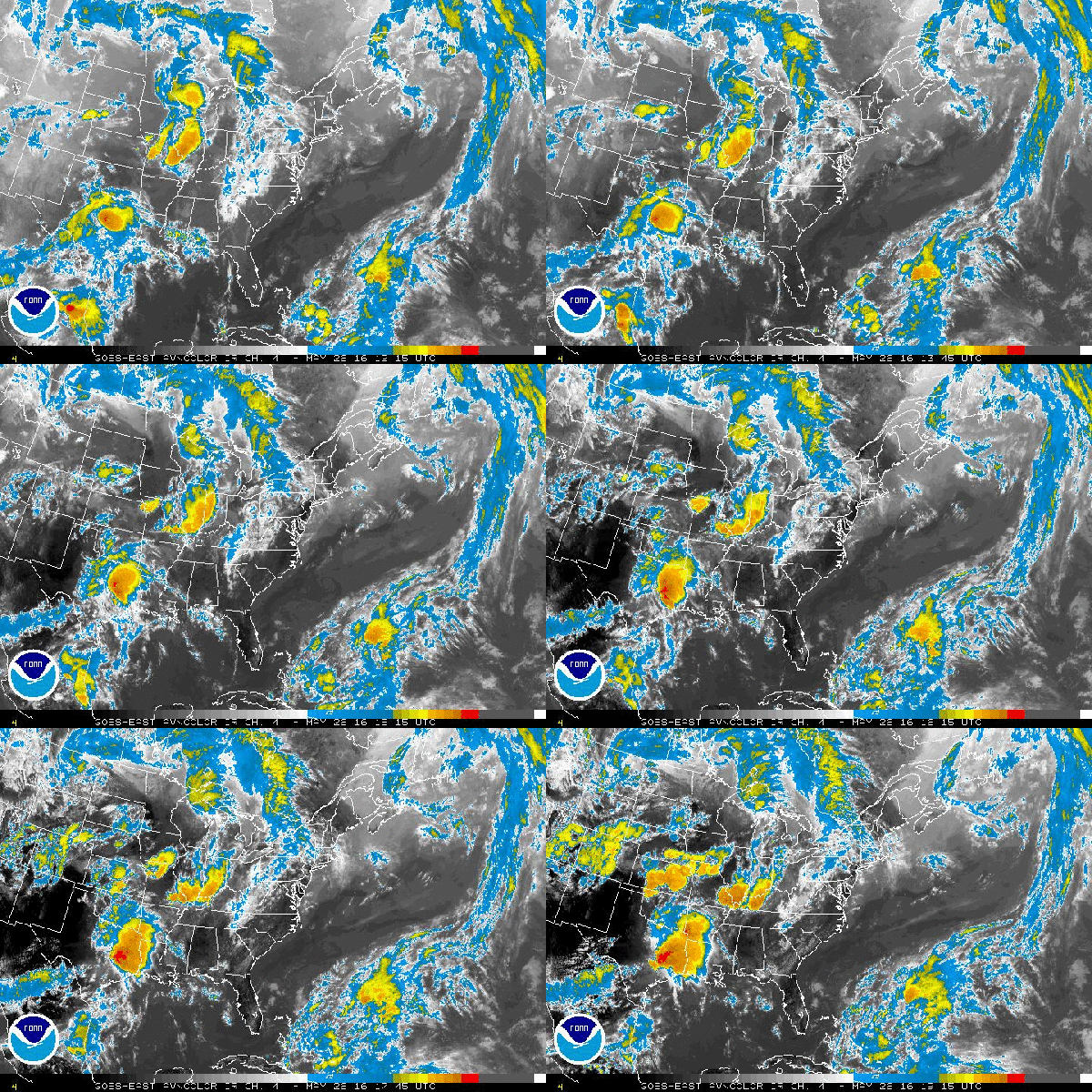
(An
area of disturbed weather in the lower right hand portion of this
image may form into tropical storm Bonnie over the next two to five
days. Image source: The
National Hurricane Center.)
Current
satellite imagery indicates high, cold cloud tops associated with
thunderstorm formation north of the low’s center of circulation.
Forecast models indicate a west-northwest storm track that ultimately
brings the low on shore near the North Carolina – South Carolina
border on early Sunday morning. Models then predict that the low will
stall out, hovering over the coastal Carolinas for the next 3-4 days.
If
Bonnie does reach tropical storm strength it
will only be the fifth time two tropical storm or hurricane strength
cyclones have ever formed before June 1 since record keeping began in
1794.
It’s also worth noting that the January formation of Hurricane Alex
already makes the 2016 season one for the record books. Increasing
ocean surface temperatures across almost all basins due to a
fossil-fuel emissions based warming of the world is likely to result
in a higher likelihood of such out-of-season storms all while
increasing the potential maximum strength of the strongest storms.
And recent events in the Pacific, Atlantic, and Indian oceans seem to
bear out these predicted trends.
Links:


No comments:
Post a Comment
Note: only a member of this blog may post a comment.