

Robertscribbler continues to do a fantastic job at chronicling the move towards what may be a blue ocean event later this year.
If they weren't aware of this and planning for it, why, it needs to be asked, would the United States navy be so active with their war games in the pristine environment of Alaska.
Hot Blob #2 Takes Aim at Sea Ice — Abnormally Warm Waters Invading the Arctic Through Bering and Chukchi
23
June, 2015
A
lot of attention has been paid to a ‘Blob’ of unusual warmth at
the ocean surface in the Northeastern Pacific. And for good
reason, for
that Blob of human-warmed water has had wide-ranging negative impacts
on both weather and sea life.
Now there’s a second hot Blob forming in the Bering and Chukchi
seas. One that may also have some rather significant effects as the
summer of 2015 continues.
Abnormally
Warm Waters Running Toward the Sea Ice
Hot
Blob #2 is a vast stretch of warm water covering the Bering and
Chukchi seas between Alaska and Kamchatka (Neven, in his most recent
sea ice summary, touched
on this building warm water zone here).
It encompasses surface waters in an usually frigid region that now
feature temperatures ranging from 3 to 5.5 degrees Celsius above
normal. Covering an area roughly 800 miles in diameter, this pool of
outlandishly warm ocean waters is being fed by currents running up
from the south and by heat bleeding off Alaskan and Siberian land
masses. In this case, land
masses that are also experiencing record heat.

(Hot
Blob #2 forms in the Bering as its warm waters are swept north toward
the Arctic sea ice pack. The above sea surface temperature anomaly
map shows a broad stretch of much hotter than typical surface waters
being pulled poleward by prevailing ocean currents. Image
source: Earth
Nullschool.)
One
warm water bearing current — the Alaskan Coastal Current — runs
directly out of the abnormally hot surface zone in the Northeastern
Pacific (Blob #1). This current flows along the North American
Continental Shelf, out past the Aleutian Island Chain and finally up
into the Bering Sea. A second current — the Siberian Coastal
Current — feeds into the Bering from the Asian Continental Shelf.
These currents then combine and push Bering Sea waters on through the
Bering Strait and up into the Chukchi Sea.
Northward
propagation of these currents during spring and summer plays a
critical role in the rate of sea ice recession in the Bering,
Chukchi, Beaufort and East Siberian Seas. Waters warmed by the summer
sun and by the more rapidly heating continents amplify in the Bering
Strait before making contact with the sea ice and pushing it to melt
and recede.
Impacts
Already Visible Up the Coast
This
year, waters in the Strait are extraordinarily warm — measuring 5.4
degrees above normal surface water temperatures. A plug of 5 C +
above average water entering the Chukchi, Bering, Beaufort and East
Siberian seas at a time when solar insolation is hitting peak
intensity and during a period when nearby
Arctic regions like Alaska are experiencing some of their hottest
temperatures ever recorded.
These waters, at temperatures in the range of 7-8 degrees Celsius,
are warm enough to rapidly melt any ice they contact. And they’re
flooding directly toward the ice pack.
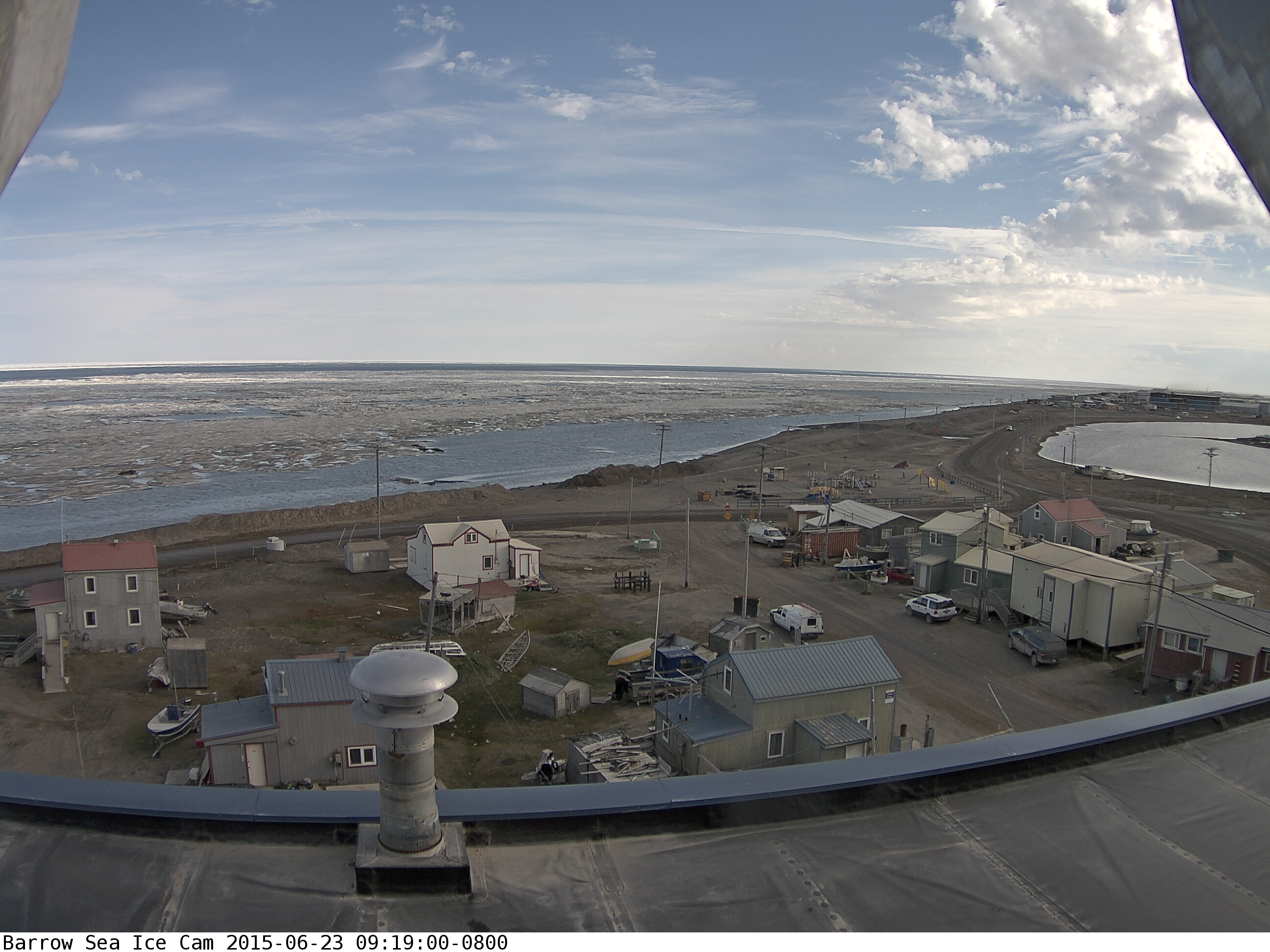
(Ice
rapidly melting off of Barrow, Alaska on June 23, 2015. Ice is seen
receding from the near shore zone even as the ice pack further out
breaks into dark blue patches of open ocean. Image source: Barrow
Ice Cam.)
Unusually
warm surface water and air temperature impacts can already be seen
further down the coast in places like Barrow, Alaska. Today, near
shore sea ice dramatically melted and off-shore sea ice has retreated
poleward — revealing the tell-tale blue of open ocean in the
distance. An extreme one day change for Barrow sea ice, which only
featured melt ponds and some near-shore melt 24 hours before.
Conditions,
Model Runs Point Toward Substantial Thinning
Looking
northward, we find ice pack conditions showing substantial thinning,
significant melt pond formation over the surface ice and increasingly
disassociated ice flows in the Beaufort, Chukchi, and East Siberian
Seas. Near shore ice in the East Siberian Sea (ESS) has taken on a
vivid blue or glassy appearance indicative of melt pond formation.
Melt and compaction wedges have formed in the ESS along an axis
pointing toward the pole. In the Chukchi, sea ice recession and
thinning appear to be proceeding quite rapidly, while dispersing ice
in the Beaufort is hitting warmer surface waters, fed by Mackenzie
River outflow, and melting.

(The
ARCc model run shows rapid thinning in the Beaufort, Chukchi and ESS
through June 30. Image source: US
Navy.)
The
Navy’s ARCc historic and forecast model run for May 30 through June
30 shows rapid thinning of sea ice in the affected regions. The
forecast run for the next seven days shows extreme thinning
continuing through the ESS and Chukchi, with thicker ice in the
Beaufort also experiencing substantial reductions (Note
that the Navy’s GLBb model runs look even worse).
Overall,
given the fact that storms are now ranging through substantial
sections of the Arctic, pushing for more sea ice dispersal, losses
will tend to show up more in the sea ice area and volume measures
first. Dispersal will also tend to mute extent losses for a time.
Given the delay in area and volume tracking, it’s likely that
overall impacts to sea ice will tend to be muted in the measures over
coming days with a clearer signal showing up by late June and early
July. But despite these underlying and complicating weather
conditions, the fact remains that a lot of unusually warm water is
heading northward toward the ice, with likely greater impacts to
follow.
Links:
No comments:
Post a Comment
Note: only a member of this blog may post a comment.