Europe waits for 'Beast
from the East' as frigid air moves closer
21 February, 2018
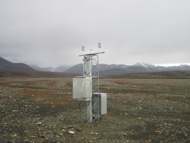
The temperature at a weather station at the very
top of Greenland, at one of the closest points of any land mass to the North
Pole, has risen above the freezing mark of 32 degrees Fahrenheit, or 0 degrees
Celsius, during the past two days.
This is an unusual, though not unheard of,
occurrence, and it illustrates the extreme weather pattern currently unfolding
in the Northern Hemisphere.
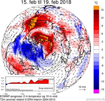
Right now, unusually high temperatures are flooding
the Arctic from the Pacific side to the North Atlantic side. Sea ice extent is
at record low levels, with the likelihood that another record low winter peak
in sea ice extent could be set by the end of March.
Sea ice loss is wreaking havoc on Arctic
ecosystems. Missing sea ice cover exposes coastal villages to flooding from
high waves during storms, and makes it harder for subsistence hunters to catch
seals and other traditional sources of meat. It also threatens iconic species
such as the polar bear.
The unusually mild (but still rather cold) temperatures in the Arctic are also related
to a recent split in the polar vortex. The polar vortex is a semi-permanent
area of low pressure in the upper atmosphere, with swirling westerly winds
circulating around it. Typically, those winds are strong enough to keep the
coldest air bottled up in the Arctic during the winter.
But during the past two weeks, a phenomenon known
as a Sudden Stratospheric Warming event took place that disrupted the polar
vortex, as if hitting a spinning top with your hand, causing it to wobble more
slowly and erratically.
The world's northernmost land based weather station @dmidk's #KapMorrisJesup has consistently measured at or above 0C for the last 12 hours.
Extraordinary weather in the high #Arctic right nowdmi.dk/groenland/maal…polarportal.dk/vejr/aktuelt-v…
In this case, the polar vortex has actually split
into two sister vortices, or two spinning tops, to extend the analogy.
One section of the polar vortex has set up shop
over the Western U.S., where record cold temperatures are being set, along with
heavy snowfall. Another is spinning its way across Eurasia, and is likely to
cause snow to fall from Siberia to the Mediterranean beaches of Italy, France,
and Croatia.
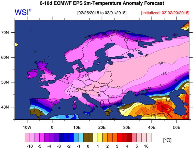
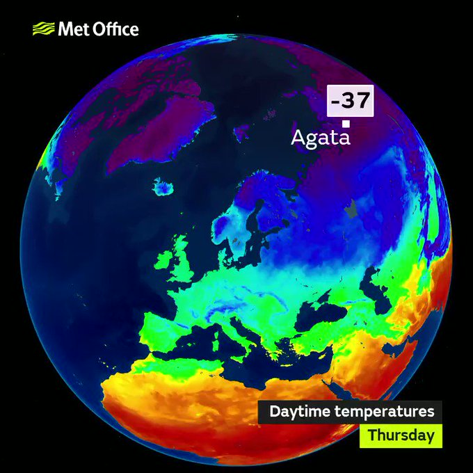
The cold could set records across Europe, including
in the United Kingdom, as easterly winds bring bitter cold into the region from
Eurasia. The UK Met Office calls the frigid air mass associated with these
easterly winds the "Beast from the East." The Met Office has also
linked the coming cold snap directly to the Sudden Stratospheric Warming event.
Sudden
Stratospheric Warming events occur when energy propagates upward from the
troposphere, where most weather occurs, into the stratosphere, setting in
motion a complex series of events that can result in the polar vortex
temporarily spilling beyond its usual boundaries, bringing exceptional cold far
and wide. This February's stratospheric warming event was particularly extreme,
possibly setting records for how sharply temperatures spiked in the upper
atmosphere.
Soon
after these events, cold air outbreaks tend to occur in Eurasia and parts of
North America, often delayed by a week or two.
Adam
Scaife, a meteorologist at the UK Met Office Hadley Center, said the Sudden
Stratospheric Warming event could keep Europe, including the UK, in the grips
of frigid air through early March.
“Signs
of this event appeared in forecasts from late January and last week we saw a
dramatic rise in air temperature of around 50 degrees Celsius, known as a Sudden Stratospheric Warming, at around 30km
above the North Pole," Scaife said in a statement. "This warming results from a
breakdown of the usual high-altitude westerly winds and it often leads to a
switch in our weather: with cold easterly conditions more likely to dominate
subsequent UK weather.”
There's
another player in the picture, too, which is also raising the odds of extreme
cold across Europe, and possibly some snowstorms for the U.S. East Coast in
early March as well. A pattern of atmospheric pressure over the North Atlantic
Ocean, known as the North Atlantic Oscillation (NAO), is flipping into a
particular phase that excites snow lovers on both sides of the Atlantic Ocean.
When
the NAO shifts into the negative phase, as it's predicted to do, the odds of
cold conditions along with more chances of snowstorms are likely both in Europe
and the eastern U.S. Computer models are showing a steep, possibly even record,
drop in the NAO index during the next two weeks, which also supports the idea
of a deep freeze in Europe.It's possible that the East Coast of the U.S. will eventually get in on the colder, snowier weather, but not until after a late February heat wave affects the area this week, with temperatures more in line with typical values seen during the month of May.


No comments:
Post a Comment
Note: only a member of this blog may post a comment.