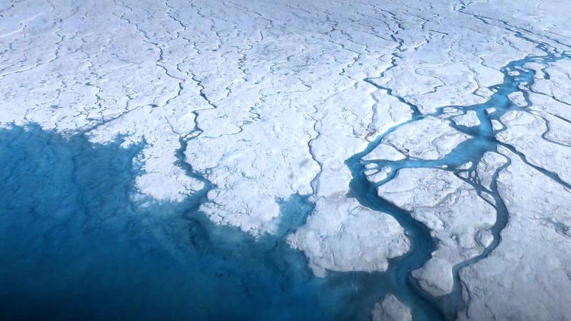
Half of Greenland's Surface Started Melting This Week, Which Is Not Normal

13 June, 2019
A
major warm spell has caused nearly half the surface of the Greenland
ice sheet to start melting, something that’s highly unusual for
this time of year. And while this spike may pass, the gears could
already be in motion for record-setting melt on the ice sheet’s
western flank.
Greenland
has been scorching (by Greenland standards) for the past few days,
with temperatures rising 10-20 degrees Celsius (18-36 degrees
Fahrenheit) above normal across the island. Ruth Mottram, a climate
scientist with the Danish Meteorological Institute, told Earther that
the weather station at the top of the ice sheet saw temperatures
reach above freezing on Wednesday and they were headed that way again
on Thursday. That puts them just a degree or so away from setting the
all-time heat record for June, which is currently held by June 2012.
The
spike in temperatures has caused a spike in melt. Roughly 45 percent
of the ice sheet surface has been melting. Normally, less than 10
percent of the ice sheet surface is melting at this time of year.
According to data from the National Snow and Ice Data Center,
Wednesday set a daily record for the widest melt area on that date,
with 275,000 square miles—an area bigger than Texas—of the ice
sheet’s surface becoming a slushy, watery mess. Mottram said the
much of the ice is likely to refreeze once the heat breaks, but it
will be more primed to melt later in the season.
Indeed,
there are a number of factors working against Greenland’s ice right
now. A spurt of heat in April kickstarted the second-earliest start
to the melt season on record. Mottram noted that the weather station
on the summit of Greenland read minus-1.2°C [29.8 degrees
Fahrenheit] on April 30, its warmest ever April recording. May
continued a trend of warmer than normal weather.
“In
fact, one of my weather forecaster colleagues rather drolly remarked
that you would have been more successful growing tomatoes outside in
Kangerlussuaq [in western Greenland] than in most of Denmark this
May, due to the very warm May without frosts there,” she wrote in
an email.
This
going-on-three months of warm temperatures comes after a very dry
winter for Greenland, particularly on the ice sheet’s western edge.
Ice sheets need snow to gain mass but also to act like a bright,
white shield that reflects sunlight away, something scientists call
the albedo effect. The low snowpack means the ice sheet’s
protection is much weaker than normal. Greenland’s ice also has all
sorts of schmutz on it as wildfire soot and other forms of black
carbon that darken its surface and absorb more of the sun’s energy.
Xavier Fettweis, a Greenland researcher at the University of Liege,
called this situation “exceptional.”
“Due
to a lower winter accumulation than normal, the bare ice area has
been exposed very early in this area enhancing the melt due to the
melt-albedo feedback,” he told Earther. “Therefore, at the
beginning of the melt season, the snowpack along the west coast is
now preconditioned to break records of melt.”
And
unfortunately, record melt is likely to be in Greenland’s future
due to the weather. The Arctic is warming twice as fast as the rest
of the world, but certain natural climate patterns can enhance that
warmth over Greenland. In particular, the North Atlantic Oscillation
(NAO), a seesaw of high and low pressure areas, can really crank up
the heat on Greenland when it’s in a negative phase. In that setup,
higher than normal pressure plops itself over Greenland and parts of
the Arctic and can lock in warm weather and sunny skies. The NAO is
negative right now and forecasts
indicate it’s like to stay negative all summer


No comments:
Post a Comment
Note: only a member of this blog may post a comment.