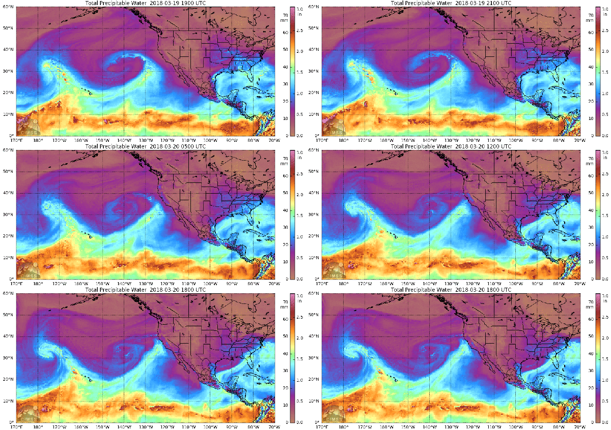
Atmospheric River Pummels West Coast as East is Slammed by Yet Another Nor’Easter
20
March, 2018
Today
the alerts were sounding in California. Areas recently denuded by
extreme wildfires such as Santa Barbara are threatened
by debris flows as
rainfall amounts of 1-6
inches (up to ten inches locally) are
predicted. Meanwhile, the U.S. East Coast braces for the fourth
strong nor’easter in three weeks.
Welcome
to your weather screwed up by human-caused climate change.
Atmospheric
River Brings Landslide Risk to California
Warmer
than normal ocean surfaces in the range of 0.5
to 2.5 C hotter than average are
bleeding off an excessive volume of moisture across the Northeastern
Pacific today. These elevated moisture levels are, in turn, forming
into a train of rain-bearing systems aimed fire-hose like at
California. This atmospheric river is expected to produce storm after
storm after storm. Systems that are predicted to dump between 1 and
locally 10 inches of rain over sections of Southwestern California
and parts of the Sierra Nevada Range over the next few days.
These
heavier than normal rains are
expected to fall over regions hard hit by last summer’s unusually
intense wildfires.
These fires were both larger and burned hotter than is typical. And,
as a result, they have denuded entire regions of trees that
previously anchored the soil. Now, with such heavy rains approaching,
California is again facing a serious risk of landslides and debris
flows.
Fourth
Nor’Easter in Three Weeks
As
flood and debris flow alerts pop across California, the
fourth strong nor’easter to form in three weeks is gathering off
the U.S. East Coast.
Like the atmospheric river presently taking aim at the West Coast,
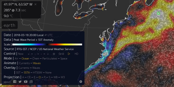
the nor’easter is gathering over waters that are much warmer than
normal — ranging as warm as 9 C above climatological averages in
parts of the Gulf Stream off Maine. And it’s also gathering energy
from an upper level pattern that has been in place since
a major polar warming event rocked the Arctic during February.
(Extremely
warm sea surfaces off the U.S. East Coast and in the Gulf of Mexico
are providing an extra intensity boost to nor’easters forming
across the region. Storms that according to recent science were made
two to four times more likely by climate change associated polar
warming events. Image source: Earth
Nullschool.)
Yesterday,
the building storm sparked severe weather across Alabama, Missippi
and Georgia — producing large hail, tornadoes and heavy rains.
Today, the
system is flinging frozen precipitation across the I 95 corridor even
as it prepares the batter the East Coast with yet one more bout of
gale force winds and heavy seas.
Conditions
in Context — The Increasing influence of Climate Change on U.S.
Severe Weather
High
sea surface temperatures, high atmospheric moisture levels, and a
polar-warming linked procession of nor’easters striking the U.S.
East Coast are
signature influences of human-caused climate change. And each is
playing a role, to one degree or another, in the pair of major
weather events that are presently developing or underway across the
U.S. To wit, the
increasingly frequent large fires across the Western U.S. have
deforested many hillsides in California and led to the increased risk
of debris flows following heavy precipitation events in parts of the
state.


No comments:
Post a Comment
Note: only a member of this blog may post a comment.