Watch this space. This is going to be HUGE!!
Intensifying Harvey On Track to Hit Texas as Major Hurricane
Intensifying Harvey On Track to Hit Texas as Major Hurricane
August 24, 2017, 9:23 PM
 |
| Above: Radar image of Hurricane Harvey at 1:30 pm CDT Thursday, taken from the lower fuselage radar on NOAA"s P-3 weather research aircraft. Image credit: tropicalatlantic.com |
24 August, 2017
Surging beyond tropical storm strength on Thursday, Hurricane Harvey is projected to become the first major hurricane (Category 3 or stronger) to strike the United States in almost 12 years. A Hurricane Warning is in effect from Port Mansfield to Sargent, Texas, including the Corpus Christi area, with a Storm Surge Warning from Port Mansfield north to High Island and a Hurricane Watch southward to the Mexico border and. Harvey poses an unusually complex, multifaceted, prolonged, and dangerous threat over the next several days to parts of South Texas, including the central TX coastline as well as locations well inland. Localized multi-day rainfall amounts could be as much as 35", according to the National Hurricane Center (NHC).
The 4 pm CDT Thursday outlook from the NHC brings Harvey onshore near Port O’Connor, TX, as a Category 3 hurricane during the predawn hours on Saturday. If you live on the coast of Texas, please heed the advice of local emergency management officials, and get out today if you live in an evacuation zone. Current trends would keep the more dangerous right-hand side of Harvey north of Corpus Christi, but residents there should pay close attention to official local statements and evacuated if advised. The city remains in the NHC cone of uncertainty, and hurricanes stray outside this cone about 30% of the time.
The 4 pm CDT Thursday Wind Speed Probability Forecast from NHC called for the greatest chances of hurricane-force winds in Port O’Connor and Rockport--about a 70% chance. Corpus Christi and Matagorda had about a 50% chance, Galveston a 19% chance, and Brownsville and Houston a 10% chance. Tropical storm-force winds may arrive along parts of the lower coast as early as 8 am CDT Friday, making evacuation difficult thereafter, according to the latest National Hurricane Center (NHC) forecast. |
| Figure 1. Visible-wavelength GOES-16 satellite image of Hurricane Harvey at 2027Z (3:27 CDT) Thursday, August 24, 2017. Image credit: NASA/MSFC Earth Science Branch. GOES-16 data are preliminary and non-operational. |
At 4 pm CDT Thursday, Harvey was centered about 300 miles south-southeast of Port O’Connor, TX (between Galvston and Corpus Christi), moving north-northwest at about 10 mph. Top sustained winds were estimated at 85 mph, or Category 1 strength. The latest Hurricane Hunter flight was a research mission that had not gathered wind data at standard heights above the surface, so the actual intensity could be somewhat higher. The researchers found that Harvey had a large, partially open eye, about 27 miles wide, that was just starting to become apparent on satellite images (see image at top). Satellite loops late Thursday afternoon showed a band of especially strong convection (showers and thunderstorms) wrapping around the west side of Harvey’s eyewall, a sign that another burst of strengthening may be about to begin. A dry slot separated the core of Harvey from a large area of convection to the northeast; this asymmetry could work against Harvey’s intensification for at least a few hours.
Intensity forecast for Harvey: Strengthening expected to continue
Now that Harvey has a well-formed structure, there are no obvious impediments to it intensifying right up until landfall. Harvey should be a Category 2 hurricane by Friday morning, and a Category 3 hurricane by Friday night, if not sooner. Harvey probably does not have enough time to become a Category 4 storm. It is possible that an eyewall replacement cycle will occur shortly before landfall, which would put intensification on hold but spread out the hurricane's strong winds over a wider area, increasing the storm surge.
The current favorable conditions for development will remain in place along Harvey’s path through Friday night, according to the 18ZThursday run of the SHIPS model. Southerly wind shear will remain light to moderate, with its effect minimized by Harvey’s northward motion, and the atmosphere will be moist. Harvey will continue to traverse sea-surface temperatures near 30°C (86°F), about 2°F above average for this time of year. The warm waters extend to considerable depth, with a total ocean heat content of 70 - 85 kilojoules per square centimeter. Beginning early on Friday, Harvey will get an extra boost in energy as it passes over a warm-core eddy that broke off from the Loop Current. The oceanic heat content within the eddy exceeds 80 kilojoules per square centimeter--enough to support rapid intensification. When warm waters are especially deep, the strong winds of a hurricane are less likely to churn up cooler water that might blunt its growth, so intensification becomes more likely.
The 12Z Thursday runs of our top intensity models—the HWRF, LGEM, COAMPS-TC, HMON, and DSHIPS—predicted that Harvey would be a Category 1, 3, or 4 storm at landfall. The HMON model was the most aggressive, predicting Harvey would max out at Category 4 strength with a 924 mb central pressure. However, the HMON had Harvey with a 966 mb pressure at 2 pm EDT Thursday, while the actual pressure was 979 mb, so the HMON forecast is likely overdone. The HWRF model was the most conservative, predicting Harvey would max out as a Category 1 storm with 90 mph winds and a 960 mb pressure. However, the HWRF had Harvey with a 984 mb pressure at 2 pm EDT Thursday, when the pressure was actually 979 mb, so this forecast is likely too conservative. The LGEM, Decay SHIPS, and COAMPS-TC models all predicted Harvey would be a Category 3 hurricane at landfall, and so did NHC in their 4 pm CDTThursday advisory. This appears to be the best intensity forecast, though we cannot rule out Harvey making it to Category 4 strength, or coming ashore as a Category 2 storm.
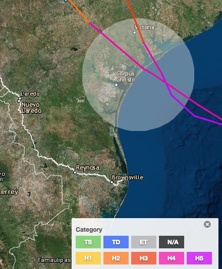
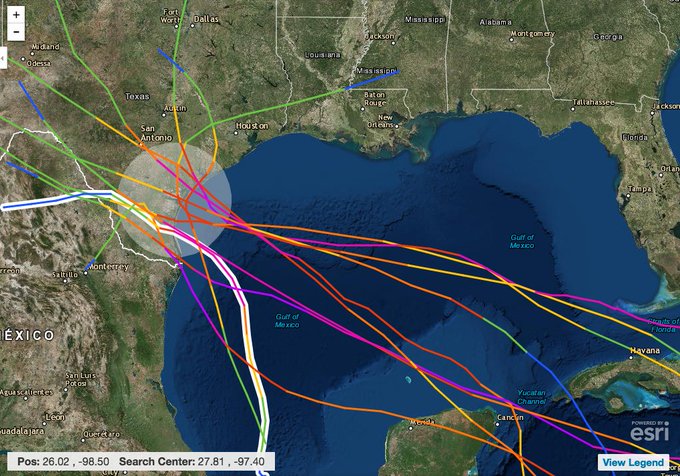
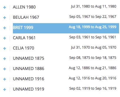
Based on these signals, residents of the central Texas coast must prepare for a major hurricane landfall. The central and lower Texas coast has experienced only one direct strike from a major hurricane in the last 47 years (Bret, 1999).
 |
| Figure 2. Intensity forecasts made for Harvey at 8 am EDT Thursday, August 24, 2017. The official NHC intensity forecast from 2 pm EDT Thursday is included (red line). Image credit: NOAA/NCEP/EMC. |
Track forecast for Harvey: A rare and worrisome scenario
The long-range track outlook for Harvey is extremely unusual and very concerning. Steering currents are expected to collapse near Harvey this weekend, and the hurricane may spend several days moving very slowly near or just inland from the Texas coast. The 12Z Thursday GFS stalls Harvey inland within 100 miles of Corpus Christi from Saturday through Wednesday. Although Harvey would gradually weaken in such a scenario, it would continue to funnel huge amounts of moisture into the southeast half of Texas. Enormous rainfall totals would be a virtual certainty. The European model depicts a shorter stall, but even this solution keeps the center of Harvey near the central Texas coast for around 48 hours. Both the GFS and European models move Harvey slowly northeast along the Texas coast and through the Houston area, with the Euro taking Harvey or its remnants into Louisiana on Tuesday and the GFS on Thursday. Either scenario would push torrential rains into eastern Texas and parts of southern and western Louisiana.
 |
| Figure 3. WU depiction of official National Hurricane Center track forecast for Harvey issued at 4 pm CDT Thursday, August 24. The hurricane is predicted to stall near the central Texas coast on Saturday, gradually weakening to tropical depression strength by Tuesday. The long-range outlook is dependent on very weak steering currents, and the location of Harvey’s expected stall could change between now and this weekend. |
Given the very weak steering currents, we can expect some variations in the forecast track and time frame of Harvey’s motion, and its intensity will be strongly affected by whether the center takes up residence just offshore, just inland, or near the coast. The take-home message is not to fixate on a particular position or timing, but to be aware that Harvey is likely to spend a long time near the Texas coast and likely to generate mammoth rainfall totals. Guidance from the GFS and European models indicates that some isolated spots could receive more than 35”, and most areas within 100 miles of the Texas coast can expect at least 5”-10”. Especially if Harvey takes a westward jog inland, the flood-vulnerable Hill Country of Texas may be at risk of extreme rainfall as well. It is still too soon to tell which areas will get the very heaviest rains from Harvey. Given the potential breadth, intensity, and duration of the rainfall, residents of the southeastern third of Texas, including the Houston area, should be ready to respond as if Harvey could produce some of the highest flood waters on record for their location.
 |
| Figure 4. The five-day precipitation forecast for Harvey issued by the NOAA/NWS Weather Prediction Center on Thursday afternoon, valid for the period from 7 pm CDT Thursday through 7 pm Tuesday, August 29, 2017. Localized totals could be even higher than the exceptionally high 24.8-inch maximum shown here. Image credit:NOAA/NWS/WPC. |
Harvey could be an unusually prolific tornado producer along the central and upper Texas coast, given its expected very slow motion near the coastline. This location would maximize the tornado-supportive wind structure within Harvey’s rainbands, especially northeast of the center. Slow-moving Hurricane Beulah, which made landfall in far South Texas as a Category 3 storm in 1967, produced a total of 115 tornadoes—just behind the U.S. record of 118 tornadoes from Hurricane Ivan (2004).
Widespread power outages can be expected with Harvey, and these may grow in scope through the weekend, as heavy rains fall onto saturated ground with strong winds continuing in some areas.
 |
| Figure 5. Tracks of Hurricane Alicia (left) and Celia (right). |
Texas hurricane history
According to NOAA’s Hurricane Research Division, the last hurricane to hit Texas was Category 2 Hurricane Ike in 2008. Ike was the most damaging hurricane in Texas history, with $34.8 billion in damage (2017 dollars), according to NOAA/NCEI. The deadliest hurricane in Texas history is also the deadliest natural disaster in U.S. history—the Great Galveston Hurricane of 1900, which killed 8,000 – 12,000 people. The last time a hurricane hit South Texas was in 2008--Category 1 Hurricane Dolly. The last major hurricane to hit Texas was Category 3 Hurricane Bret of 1999, which made landfall along Texas’s Padre Island, midway between Brownsville and Corpus Christi. Due to Bret’s small size and the sparsely-populated region of the coast it hit, damage was limited to $60 million, and just one life was lost; Bret’s name did not get retired. Hurricane Rita of 2005 was rated as a Category 2 landfall for Texas, but was a Category 3 landfall for southwest Louisiana.
There are several historical cases of August hurricanes undergoing rapid intensification to Category 3 status just before landfall in Texas.Hurricane Alicia of 1983 took 36 hours to intensify from a tropical storm with 70 mph winds to a Category 3 hurricane with 115 mph winds. During that time, the pressure dropped from 998 mb to 963 mb. Alicia killed 21 people and caused $1.7 billion in damage (1983 dollars.)Hurricane Celia of 1970 took twelve hours to intensify from a Category 1 hurricane with 85 mph winds to a Category 3 hurricane with 125 mph winds just before landfall. Celia hit the coast very close to where Harvey is expected to, killing 27 and causing $930 million in damage (1970 dollars.)
We’ll be back with an update late Thursday night.
Jeff Masters co-wrote this post.


Could Harvey be the black swan that triggers economic collapse?
ReplyDeleteIt may have a major nation-wide effect on gas prices and property insurance rates, either of which has the potential to be "the straw that breaks the camel's back" in an economy as precarious and vulnerable as that of the U.S.
You may well be right. There is also the possible effects on nuclear reactors. Houston is America's 4th largest city somitbis no mere trifle.
ReplyDelete