New Zealand:Evacuations
after heavy rain, floods and slips in Wellington region
Stuff,
14
May, 2015
State Highway 2 has been closed.
With
roads turned into rivers, major highways blocked and trains
cancelled, getting home tonight is a major challenge for thousands
in the Wellington region.
And some of those homes are flooded
The
region was hit by a deluge of rain overnight causing slips and
flooding,
with 117.4mm falling in Paraparaumu and 96mm in Lower Hutt
in the last 24 hours.
Residents are being advised by Civil Defence to stay out of floodwaters because of potential sewage contamination and electrical danger.
State Highway 1 has re-opened but is restricted by flooding. SH2 is closed northbound between Ngauranga and Melling, and southbound at Petone.
Motorists wanting to reach Hutt Valley from Wellington need to use SH1 as far as Porirua and then take SH58 over Haywards Hill. Kapiti residents in Wellington have been advised to seek alternative accommodation in the city.
All commuter train services across the Wellington region have been cancelled and Wellington Railway Station is closed.
Schools, businesses and homeowners have all been affected, with 18 homes evacuated.
A man swept under a bridge in floodwaters in Paraparaumu was helped to safety by bystanders. Another person has reportedly been rescued from the Waikanae River.
Melbourne
weather: Snow’s falling, winter is unofficially here
Herald Sun,
13
May, 2015
THE
ski season kicked off early and snow fell at Kinglake and Mt
Dandenong as Melbourne received a premature taste of winter today.
As
of 10am it was 7C in Melbourne, but with the wind it feels like 2C or
3C, the Bureau of Meteorology says.
Forecaster
Dean Stewart said it wasn’t so unusual to get cold bursts like
this.
“It’s
a bit of a shock to the system I guess, when you get a bit of snow at
the Dandenongs,” he said. “The last time it snowed there was in
August.”
Rain
clouds roll into Melbourne. Picture: Tony Gogh
It
plummeted to minus 6C in the Mt Hotham and Falls Creek area.
Mr
Stewart confirmed there had been a couple of storms in Melbourne this
morning but the risk of further storms this afternoon appears to have
contracted.
However,
more hail and thunder were on the cards.
Caller
Glenn told 3AW it was snowing in the Kinglake town, 46km northeast of
the CBD just before 6am while the white stuff was also reported at Mt
Dandenong, 35km east of Melbourne.
Melbourne
is set for a top of 13 degrees and a very high chance of rain,
especially this morning, and snow falling on peaks above 600 meters.
Local
hail and thunder is also possible, mainly this morning, and
south-westerly winds will peak at up to 40kmh.
Melburnians
have turned to social media to share their snow photos.
An
East Bentleigh resident posted a picture of Cedric Bradley, 3, who
made a hail person following the hail dump in their neighbourhood.
Battling
the elements in William St CBD. Picture: David Smith
Traffic
has also been affected, with trams and trains running late and
cancelled.
Due
to heavy peak-hour traffic on Sydney Rd in Melbourne’s north, some
route 19 trains were terminating before the scheduled stop at
Flinders St, with delays, according to Yarra trams.
The
Frankston Line has also experienced delays, and commuters on the
Cranbourne line were held up due to a medical emergency at Caulfield.
Melburnians
woke to a bitterly cold autumn day. Picture: Hamish Blair
Weather
Service: Anchorage's last winter unofficially least snowy on record
Alaska Dispatch News,
13
May, 2015
This
past winter was unofficially the least snowy on record in Anchorage,
the National Weather Service Alaska Regional Office declared
Wednesday.
“We’re
pretty confident in this prediction,” NWS posted on Facebook.
“We’ve
never had more than half an inch of snow fall past this date at
Anchorage’s official measuring station.”
Only
25.1 inches of snow fell during the 2014-15 winter season, NWS
reported. That beat the previous low-snowfall record set in 1957-58,
which saw 30.4 inches of snowfall.
The
year with the heaviest snowfall on record was 2011-12, when 134.5
inches of snow were recorded.
The
seasonal average is 74.5 inches, according to NWS.
Seasonal
snowfall is recorded through June 30, making the pronouncement
unofficial until that date.
“But
seriously, who cares about winter records in June … when the
sockeye are running?” NWS said.
US
battered by severe storms and tornadoes
Euronews,
12
May, 2015
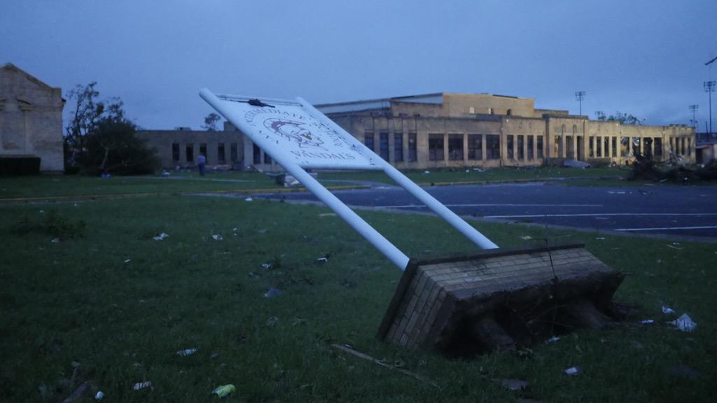
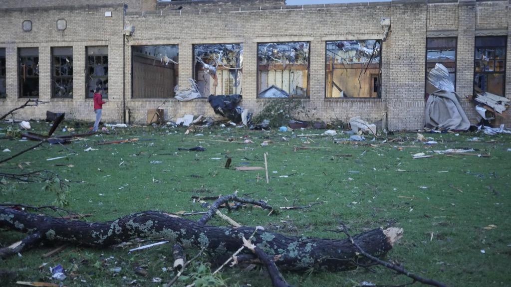
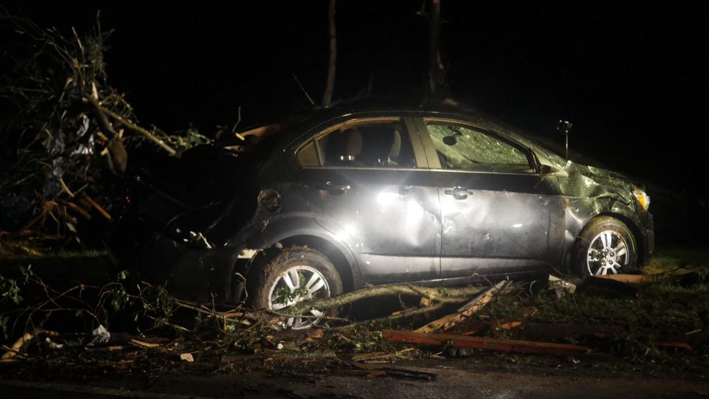
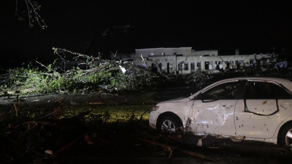
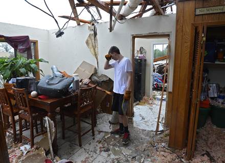
Towns
in the US Great Plains have been battered by a series of tornadoes,
leaving a trail of destruction in their wake. Six people have died as
the severe storms ripped through the area on Sunday night.
In
Arkansas a young couple were killed protecting their 18-month-old
baby when their mobile home flipped over.
Surveying the damage in Nashville from Sunday's EF-2 tornado with @RepWesterman.
In
Texas, the governor declared a state of emergency due to severe
storms and flooding. The residents of Van experienced a killer
tornado which ripped up trees, power lines and destroyed homes.
Standing
outside what remains of her home, Kimberli Shane described the moment
the tornado hit.
“Horrifying.
We didn’t hear the sirens. My son came in. This is his room or it
was his room.”
As
search and rescue efforts continue at least eight people remain
unaccounted for in Van.
LATEST: At least 2 dead, 8 unaccounted for after tornado roars through Van, Texas http://nbcnews.to/1J4UnaY
The
same day that Winter Storm Venus dumped record-breaking snowfall on
South Dakota, it was also hit by tornadoes.
“The
power of the tornado, you could just hear it, I mean, it was like it
was just trying to suck you from inside out,” explained resident
Marc Mora. “I mean just the pressure, your ears and everything are
popping. But it was — it’s something I don’t wish on anybody.
That was a scary moment there.”
Since
last Tuesday an estimated 137 tornadoes have touched down in the US.
Clean
up efforts will be hampered as flooding is expected to continue
through mid-week.
Meanwhile
there has been flooding in Nairobi, Kenya
Heavy rains in Nairobi cause flooding and destruction
Heavy rains in Nairobi cause flooding and destruction


 Gov. Asa Hutchinson








 NBC Nightly News


No comments:
Post a Comment
Note: only a member of this blog may post a comment.