Showing posts with label tundra. Show all posts

Sunday, 3 November 2019

The 'greening' of Siberia


Poppies, dandelions and 

daisies bloom in never 

before seen Arctic oases

Discovery of rich vegetation only 1000 miles away from North Pole surprises scientists.
The photographed area is 70th parallel north - with a distance to North Pole of only 1043 miles - where Russia has its northernmost residential settlements of Western Siberia. Picture: Sergey Loiko
Siberian Times,
16 October, 2019


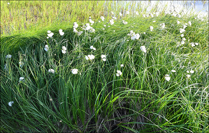
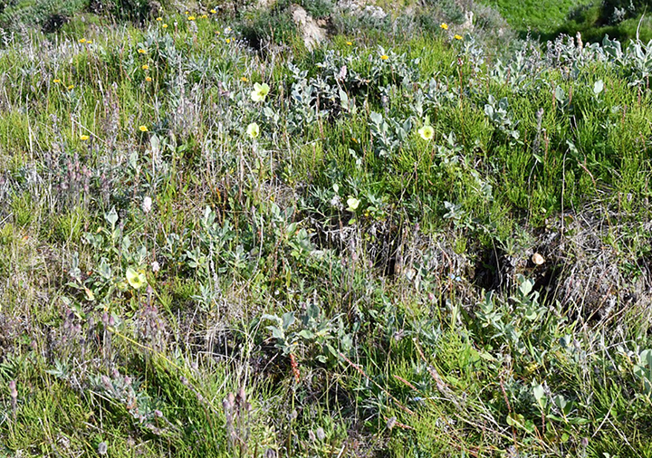
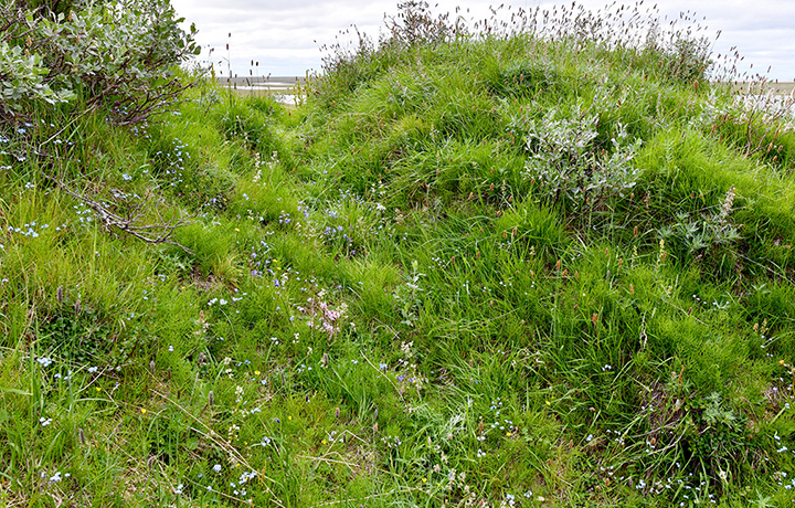
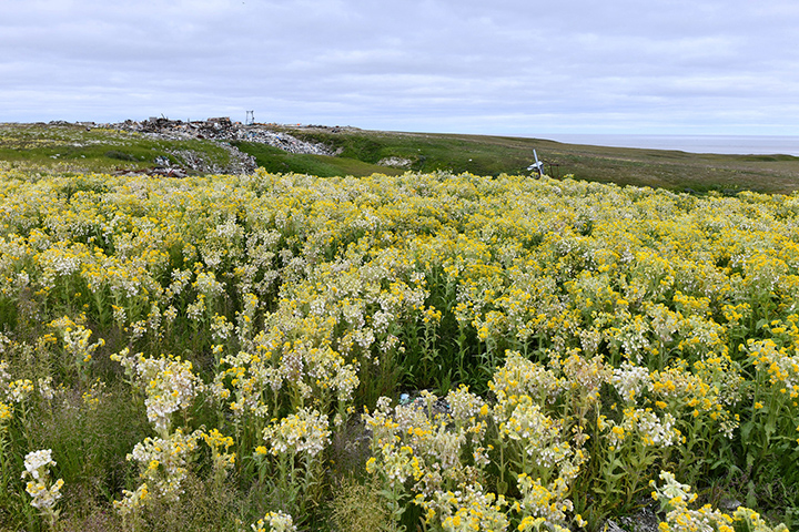
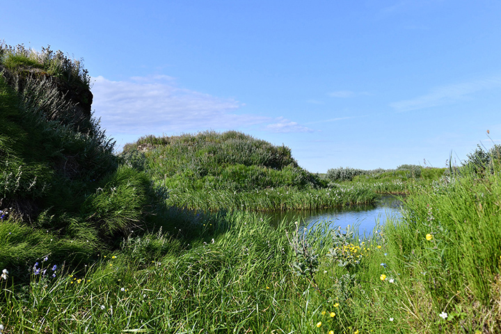
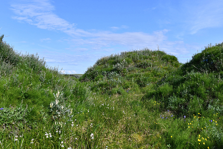
Blooming’ might be the last word to associate with the Arctic, yet pictures below 
show meadows bursting with life as brightly-coloured flowers blossom in lush 
green grass.

And while vegetation in khasyreis, basins of drained Arctic lakes, is less of a 
surprise, researchers discovered ‘bursts of life’ next to a residential settlement 
where permafrost ice veins were broken when people dug sand pits.

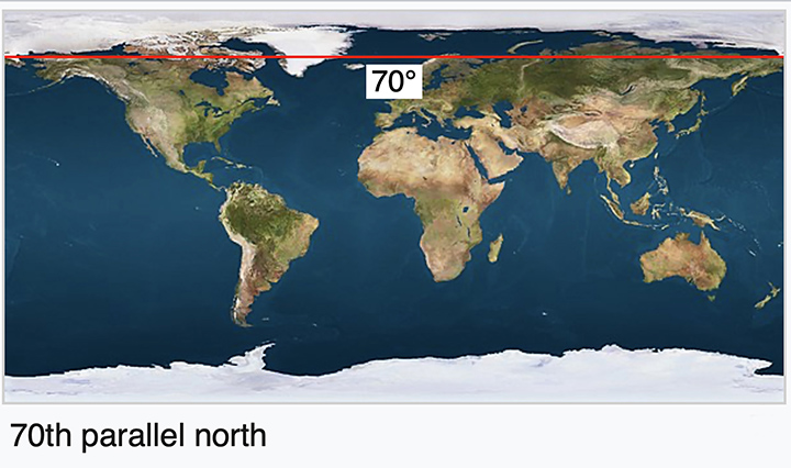
The photographed area is 70th parallel north - with a distance to North Pole of 
only 1043 miles - where Russia has its northernmost residential settlements of 
Western Siberia. 
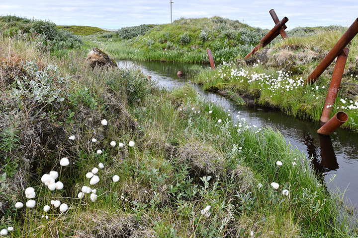
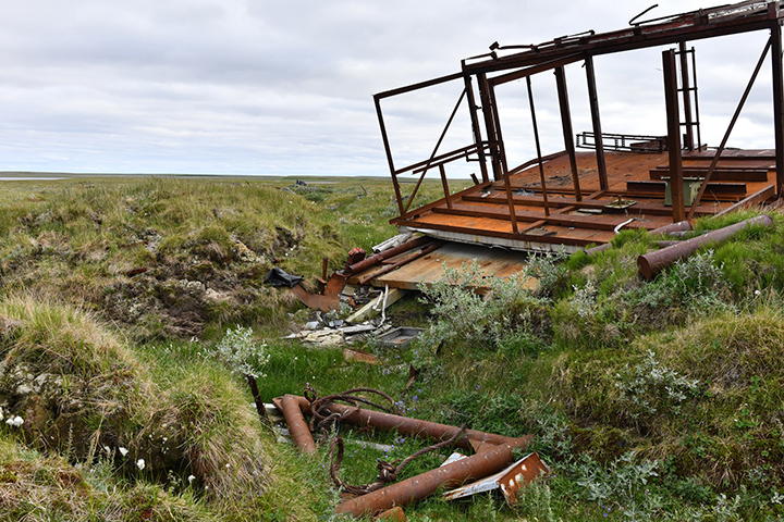
There, in bleak Arctic tundra summer-2019 expedition organised by Tomsk State University found oases of rich vegetation formed in places of actively thawing permafrost.


Poppies, dandelions and daisies bloom in never before seen Arctic oases

Poppies, dandelions and daisies bloom in never before seen Arctic oases

Poppies, dandelions and daisies bloom in never before seen Arctic oases

Poppies, dandelions and daisies bloom in never before seen Arctic oases

Poppies, dandelions and daisies bloom in never before seen Arctic oases
‘Blooming’ might be the last word to associate with the Arctic, yet pictures show meadows bursting with life as brightly-coloured flowers blossom in lush green grass. Pictures: Sergey Loiko

As researchers explained, initially ice veins in permafrost were broken when 
people dug sand pits.

Over time disturbed permafrost thawed and enriched soil with minerals from its 
deep frozen layers. As soil above permafrost continued to move, broken cover of 
moss and lichen also subsided, preparing space for seeds of herbs and cereals.

Warm summers sped up seeds germination, so that when Russian researchers 
arrived they saw carpets of herbs and flowers, with daisies, dandelions, polar 
poppies, horsetail, several types of wormwood, cereals and even willow growing 
in Arctic ‘oases’. 
Poppies, dandelions and daisies bloom in never before seen Arctic oases

Poppies, dandelions and daisies bloom in never before seen Arctic oases
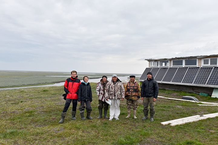
Tomsk State University's expedition pictured during summer 2019 expedition to the Yamal Peninsula. 
Pictures: Sergey Loiko
It all came as a surprise as the expedition travelled to the Yamal peninsula with 
a different aim - to study dried-up basins of local lakes, or ‘Khasyreys’ - and didn’t expect to see signs of such active vegetation elsewhere. 

Khasyreis usually form over quite a long time, in decades actually’, said Sergey 
Loiko, senior researcher at laboratory for biogeochemical and remote methods of monitoring the environment at Tomsk State University (TSU). 

Nowadays as Tomsk expedition confirmed, Khasyreys take just weeks to form.
Poppies, dandelions and daisies bloom in never before seen Arctic oases

The photographed area is 70th parallel north - with a distance to North Pole of only 1034 miles - where Russia has its northernmost residential settlements of Western Siberia
Discovery of rich vegetation only 1000 mile away from North Pole surprises scientists. Pictures: Sergey Loiko
In summer 2016 which was quite hot, one lake drained entirely in less than a month through gaps in thawing permafrost. By the time Tomsk expedition arrived to the lake its bed was covered with herbs and cereals.

Russian researchers concluded that Khasyreis were forming much faster during the past 30 years, doubling the number of such landscapes in Arcric tundra and showing there is tendency for the Arctic to become warmer and greener.


While it was surprising to discover oases of lush vegetation so high up in the Arctic, researchers believe this is the smallest of the issues. Potential threat to the infrastructure is more worrying.

Local thermokarst is not as worrying as it might seem as Arctic plants formed in the Pleistocene under the influence of constant moderate disturbances. The local flora is well adapted to it. Permafrost thawing is undesirable because of potential threat to infrastructure, because of potential damage it might cause to roads’, Sergey Loiko explained.

In the future, changes and expansion of the Arctic flora might lead to appearance of a bigger variety of fauna and bring over animals that have never populated this area.

Monday, 13 June 2016

Unstoppable tundra fires

The embers of last year’s wildfires are coming back with a vengeance
BETHEL – Hidden underground all winter, an unusual number of holdover fires that smouldered for months in Alaska’s deep duff already have reignited this fire season, state forestry officials said Wednesday.


2 June, 2016


Last year was the second-largest fire season on record in Alaska and 2015 “is still smoking,” officials said. One holdover on Sunday sparked the 8,130-acre Medfra fire now burning in remote Southwest Alaska.
Already 16 holdovers have been spotted, most of them on the Kenai Peninsula or Kodiak Island. Holdover fires are ones that firefighters thought were out, but come back to life as conditions dry out and temperatures rise.
Hot spots

Most of them start out as just little hot spots,” said Tim Mowry, the state Division of Forestry public information officer. “The term fire is sort of a misnomer. They are not really fires. They are usually a little bit of smoke coming out of a burned area.”
The count of 16 that have signaled their presence as of Wednesday appears to be extraordinarily high. Some years there are none; some years just a few. There aren’t records on holdovers, though. Mowry said officials may start tracking them year to year.
It also could be the holdovers are more exposed than usual this year, a state fire behavior expert said.
Mushroom lovers drawn to last year’s wildfire burns as prime picking grounds spotted many of the Kenai smoke-ups, Mowry said.

Safety hazard’

Fire officials warn people to be cautious in burned areas and to call in any smoke rising up from the blackened ground.
It is definitely a safety hazard,” Mowry said.
Alaska is prone to wildfires, and the threat may be worsening. Three of the top five fire seasons on record for Alaska have happened in the last 12 years. Fires are burning hotter and the fire season is starting earlier and lasting longer.
Holdovers also are common here, just not so many as this year, because of the deep duff layer of composting moss, twigs, leaves and spruce needles that blankets the forest floor or the rotting organic underlayer of the tundra.
It’s the nature of Alaska and the thick layer of duff that we are talking about,” Mowry said. “It shows you Alaska wants to burn.”

Hard to fight


Once a fire is established, it is very hard to completely douse, said Robert Ziel, the forestry division’s fire behavior analyst.
Fires burrow down and the duff above them absorbs the moisture.
It’s almost like an umbrella over that fire that keeps it insulated and dry,” Mowry said.
Last summer, more than 5.1 million acres burned, the second largest expanse on record, according to the state. That big fire year combined with low snow last winter and a warm dry spring all may have combined to allow more holdovers.
Fire managers send in crews to try and put down holdovers at the perimeter of an already burned area but aren’t as worried about those surrounded by charred land.
Anything that has the capability to reach out and grab unburned fuel is a concern,” Mowry said.

Medfra fire keeps growing


In Southwest Alaska, officials are attributing the big Medfra fire that started Sunday 50 miles northwest of McGrath to a holdover. It was called in as a smoke report in an old burn area, then quickly spread to fresh fuel. A helicopter from McGrath arrived to dump buckets of water on it within an hour, but by then it had spread over an acre. Smokejumpers stationed in McGrath attacked but it kept growing.
Tuesday night, the Medfra fire merged with the smaller Berry Creek fire, combining for an estimated 8,130 acres burned or burning. The two are among three Southwest Alaska holdovers from the Soda Creek fire that burned about 16,500 acres last summer in the same area near the Kuskokwim River.
About 80 firefighters in four crews were working to protect Native allotments and two cabins on Wednesday. White Mountain’s initial attack crew and crews from Lower Kalskag, Upper Kalskag and Nondalton were on the scene.

More holdovers


On the Kenai Peninsula, all but one of the holdovers were found in the burn area of the Card Street fire that scorched almost 8,900 acres last year near Soldotna. The exception was a holdover from the Funny River fire, which burned almost 200,000 acres – two years ago.
There is also a holdover in the Mat-Su from last year’s Sockeye fire.
Here are the five biggest Alaska wildfire seasons on record:
2004: 701 fires, 6.6 million acres
2015: 768 fires, 5.1 million acres
1957: 391 fires, 5 million acres
1939: 200 fires, 5 million acres
2005: 624 fires, 4.6 million acres

Related stories from around the North:


United States: How tundra wildfires could create an unstoppable cycle, Alaska Dispatch News


Warming, fires, warming, fires: How tundra wildfires could create an unstoppable cycle


Yereth Rosen, Alaska Dispatch News 
2007. Anaktuvuk River Fire, North Slope, Alaska. (Alaska Fire Service).2007. Anaktuvuk River Fire, North Slope, Alaska. (Alaska Fire Service).
When lightning sparked a big fire in the tundra of Alaska’s Arctic North Slope nine years ago, scientists were stunned.


The Anaktuvuk River fire grew to more than 400 square miles and burned for months. It was bigger than the cumulative total of all prior North Slope tundra fires dating back to the 1950s.
If Alaska’s warming trend continues, such fires will no longer be so extraordinary, according to a new analysis led by University of Montana researchers.

Increased probability of fires


Their study, published online in the Sweden-based journal Ecography, uses past fire behavior and conditions to calculate probabilities of wildfires in 30-year timespans. If July temperatures average 13.4 degrees Celsius (56.1 degrees Fahrenheit) and moisture levels are relatively low, wildfires will become significantly more frequent, according to the analysis.

The probability that an area will burn increases a lot,” said co-author Philip Higuera, an associate professor of fire ecology at the University of Montana.
The biggest jump in probability of big fires is for areas that don’t typically burn — the usually moist tundra of the North Slope and similar areas in western Alaska. If the 13.4-degree threshold is reached there, the probability calculations predict up to a fourfold increase in wildfire.

Unprecedented’ fire danger


In tundra regions like the North Slope and the Yukon-Kuskokwim Delta, the fire danger will be “unprecedented” compared to the last 6,000 to 32,000 years, the study says.
The Anaktuvuk River fire in the northern Brooks Range foothills might have been a signal of what is to come.
Anaktuvuk River fire, North Slope, Alaska, near the village of Anaktuvuk Pass, in 2007. (Michelle Mack)
The 2007 Anaktuvuk River fire, North Slope, Alaska, near the village of Anaktuvuk Pass. (Michelle Mack)

The 2007 fire was probably the first for that area in 6,500 years, according to scientific evidence examined later, Higuera said. But the wait for the next big burn won’t be nearly as long, according to the evidence gathered in the study.
That’s what the projections suggest, that we would expect to see more of those,” Higuera said.

More frequent fires


By the late part of this century, wildfires will burn more frequently in nearly all of Alaska, the calculations predict; in a wide swath of the state, the probability of fires will more than double by the middle of the century.
In some places — chiefly, the Interior Alaska boreal forest, where fires are already frequent — the increases may be already underway, Higuera said. Several past studies point to that same conclusion, he said.

Fairbanks has already passed the 13.4 degree Celsius threshold for average July temperatures, and Fort Yukon in the eastern Interior region is expected to reach that point by the end of this decade, according to projections by the University of Alaska Fairbanks’ Scenarios Network for Alaska and Arctic Planning — the same set of projections used in the study to calculate future fire probabilities.

Temperature thresholds


In other parts of Alaska, the July temperature threshold is in reach.
Bethel, the biggest community in the Yukon-Kuskokwim region, and Kotzebue in northwestern Alaska, will soon be at the July temperature threshold, even if global greenhouse gas emissions are reduced from current levels, according to the SNAP projections. Farther north, communities like Anaktuvuk Pass and Nuiqsut could have July temperatures averaging above 13.4 degrees by the late part of century, according to the SNAP projections.
While a warming climate primes Alaska for more frequent wildfires, the fires themselves contribute to warming — and create yet more favorable fire conditions.

Smoke effect


Smoke from wildfires has deposited soot particles onto sea ice, which is already fragile for this time of year compared to recent averages. Darkened ice and snow melts faster, further weakening the ice coverage.
NASA last used satellite imagery to track smoke from fires in Alaska and Canada swirling across the Northern Hemisphere, including the Arctic Ocean, and over the Greenland Sea. NASA in 2014 captured satellite imagery of Russian wildfire smoke drifting over the Arctic Ocean. Smoke from Canada’s huge Fort McMurray fire is now clouding the skies in Europe.

Tundra fires are notable for the sequestered carbon they release from the earth in the form of smoke and exposure of subsurface soil. The Anaktuvuk River fire opened a vast swath of tundra, sending carbon into the atmosphere that had been locked in the soil for as long as 50 years, scientists from the University of Alaska Fairbanks and other institutions found and detailed in a 2011 study published in the journal Nature.

Feedback loop

The darkened surface left by tundra fires reduces the ground’s ability to reflect solar energy back into space, a measure called “albedo,” scientists say. It took four years for the area charred by the Anaktuvuk River fire to return to pre-fire albedo levels, says a new study by scientists from the Michigan Tech Research Institute. Even a much-smaller tundra fire in the Brooks Range foothills, the 2012 Kucher Creek fire, reduced albedo, causing solar heat to be absorbed rather than reflected back, says the study, published in the Journal of Geophysical Research Biogeosciences.

That could lead to future warming, possibly in a significant way, the study says.
The University of Montana-led study calculating future frequency is not a forecast for the coming season or for any year in particular, Higuera said. Instead, the study looks at decades-long trends and cycles, he said. More immediate predictions are available in the national wildfire outlook, which forecasts a fairly normal fire season this year for Alaska.


Friday, 6 May 2016

Peat fires in the tundra and other articles related to the Alberta wildfires

This is a collection of articles that provides some context to the wildfires in Alberta – something sorely missing from the media discussion that fails to even tell us that Fort McMurray is situated in the tar sands area of Alberta, that this is conencted to unprecedented heat caused by disruption of the jetstream, a major symptom of abrupt climate change.


Join the dots.

****
According to the authors, their observations of carbon loss from the Anaktuvuk River fire support the idea that tundra fires have the potential to release large amounts of carbon and decrease landscape carbon stocks, having an immediate impact on atmospheric carbon and climate.”


Largest recorded tundra fire yields scientific surprises


This NASA MODSIS image of the North Slope of the Brooks Range in Alaska shows the Anaktuvuk River fire scar in the lower right quarter of the image. Credit: NASA/GSFC, MODIS Rapid Response

27 July, 2011

In 2007 the largest recorded tundra fire in the circumpolar arctic released approximately as much carbon into the atmosphere as the tundra has stored in the previous 50 years, say scientists in the July 28 issue of the journal Nature. The study of the Anaktuvuk River fire on Alaska's North Slope revealed how rapidly a single tundra fire can offset or reverse a half-century worth of soil-stored carbon.

Tundra soils store huge amounts of carbon hundreds to thousands of years old. Intact, the layers of organic soil insulate the permanently frozen ground, called permafrost, below.

"Fire has been largely absent from tundra for the past 11,000 or so years, but the frequency of tundra fires is increasing, probably as a response to climate warming," said co-author Syndonia "Donie" Bret-Harte, an ecosystem ecologist at the University of Alaska Fairbanks Institute of Arctic Biology.

The Anaktuvuk River fire burned 1,039 square kilometers (401 square miles), an area roughly the size of Cape Cod and visible from space, and released more than 2.1 teragrams (2.3 million tons) of carbon into the atmosphere. Radiocarbon dating of the soils revealed the maximum age of the soil carbon emitted from the fire was 50 years.

"The amount of carbon released into the atmosphere from this fire is equivalent to the amount of carbon stored by the global tundra biome," said lead author Michelle Mack, a biologist from the University of Florida. "This was a boreal forest-sized fire."

Little is known about the effects of fire on carbon storage and cycling in tundra ecosystems. Cool, wet soils underlain by permafrost are thought to restrict fires to aboveground plants and ground-level plant litter leaving the carbon stored in soils relatively intact. As arctic summers get warmer and dryer, so too do the soils, which are highly flammable and able to burn more deeply when dry.

"If the frequency of these fires remains at long intervals, 80 to 150 years, then the tundra has time to recover," Bret-Hart said. "If these fires occur more frequently, say every 10 years or so, then the landscape cannot recover."

The Anaktuvuk River fire was started by a lightning strike in July 2007. "Normally we would expect the fire to go out in the moist soil, but this summer was so dry that the fire didn't go out and strong winds in September caused it to burn a very large area," said Bret-Harte, who noted that 40 percent of the fire was classified as a severe burn – high for a tundra fire. The fire was visible 24 kilometers south at the IAB Toolik Field Station, where the scientists were working, as a wall of smoke on the horizon.

In addition to the direct release of carbon into the atmosphere, tundra fires are important because of the potential feedbacks to global climate change. "These fires could be a radical and very rapid positive feedback to atmospheric carbon dioxide," said Mack.

Fire removes organic material that insulates permafrost from warm summer temperatures. Insufficient insulation can lead to thawing permafrost, destabilization of the ground surface and exposure of deep soil carbon to decomposition and release into the atmosphere – ultimately amplifying high-latitude warming.

According to the authors, their observations of carbon loss from the Anaktuvuk River fire support the idea that tundra fires have the potential to release large amounts of carbon and decrease landscape carbon stocks, having an immediate impact on atmospheric carbon and climate.


Provided by: University of Alaska Fairbanks


Greenpeace warns fires raging across forest and peatlands will match the worst year ever and exceed the total annual carbon output of the UK

Fires raging across the forests and peatlands of Indonesia are on track to pump out more carbon emissions than the UK’s entire annual output, Greenpeace has warned.

As well as fuelling global warming, the thick smoke choking cities in the region is likely to cause the premature deaths of more than 100,000 people in the region and is also destroying vital habitats for endangered orangutans and clouded leopards.

New drone video footage from Greenpeace from around the Gunung Palung national park in Kalimantan shows the peat fires smouldering underground, as well as flames burning down trees, and the thick haze they produce.

There have been almost 10,000 fires in the last month across Kalimantan (Indonesian Borneo) and Sumatra, with the drifting smoke also provoking protests from neighbouring Malaysia, Singapore and Thailand......

The record forest and peat fires of 1997 produced huge carbon emissions, estimated by scientists at between 0.81 and 2.57 gigatonnes (Gt), equivalent to 13-40% of the entire world’s annual fossil fuel emissions. It lead to the biggest annual jump in CO2 ever recorded. By comparison, the UK’s carbon emissions for the whole of 2014 were 0.52Gt.

The health impact of the forest and peat fires is also expected to be large, with the resulting premature deaths across south-east Asia estimated at 110,000 deaths in an average year. More than 75,000 people are already suffering from upper respiratory infections as a result of the haze, according to media reports.


Indonesia's peat fires make it the 4th-largest carbon emitter in the world


Indonesiafi.bf009


"The McMurray Formation is a stratigraphic unit of Early Cretaceous age (late Barremian to Aptian stage) of the Western Canada Sedimentary Basin in northeastern Alberta.[3] It takes the name from Fort McMurray, and was first described in the outcrops exposed along the banks of the Athabasca River, 5 KILOMETERS (3.1 mi) north of Fort McMurray, by F.H. McLearn in 1917.[4] It is a well-studied example of fluvial to estuarine sedimentation, and it is economically important because it hosts most of the vast bitumen resources of the Athabasca Oil Sands region."


Danger map shows 'extreme' risk of fires in both provinces


As tens of thousands of residents flee from Fort McMurray, Alta., the threat of more fires continues to loom across Alberta and Saskatchewan.

On May 4, Natural Resources Canada indicated that the risk of fire is "extreme" in the two provinces.

A map the federal department produced for Wednesday shows a huge red zone over most of the region.

The Canadian Wildland Fire Information System is a computer-based system that monitors fire danger conditions across Canada.

The system creates a fire danger map based on daily weather conditions such as temperature and humidity.

It also takes into consideration factors like how easy it is to ignite vegetation, how difficult a fire may be to control, and how much damage a fire can do.


There appears to be little relief on the way to help with this year's uncharacteristically early start to British Columbia's fire season. BC Wildfire Service spokesman Kevin Skrepnek says cooler temperatures forecast for the coming days are unlikely to bring much rain and that worsening winds will likely only fan the flames.

British Columbia has turned down a request for help from Alberta to send firefighters to help battle the Fort McMurray blaze, as the province struggles with an early start to this year’s wildfire season.

Ryan Turcot, an information officer with the B.C. Wildfire Service, said Alberta made a request for help Tuesday through the national Canadian Interagency Forest Fire Centre. Requests go to all provinces and territories, so that those jurisdictions experiencing lower levels of activity can lend resources if available.

But B.C. is currently experiencing high levels of fire activity, especially in the Peace River Region, where more than 50 fires are burning and five evacuation alerts are in place. “Our personnel are currently fully engaged across the province,” said Turcot, in an email Wednesday morning.

Given the current level of fire activity in B.C, and the need to maintain necessary resources here, B.C. was unable to lend crews at this time. Future requests will be considered,” he said.


Smouldering peat fires already are the largest fires on Earth in terms of their carbon footprint,”explained mega-fire expert Prof. Guillermo Rein last week.

He is coauthor of a new study called “Global vulnerability of peatlands to fire and carbon loss,” which warns that massive, difficult-to-stop peatland fires are likely to become even larger in the future, as human activity keeps drying out the formerly wet peatlands.

Since a key reason many peatlands will become drier is global warming, and since peatland fires can release staggering amounts of carbon dioxide, this process is a vicious circle, a dangerous amplifying carbon cycle feedback.

From Indonesia to Botswana, from Scotland to North Carolina, peat mega-fires burn for months, destroy habitat, clog the air with haze, and self-accelerate climate change impacts.


Smouldering combustion is the slow, low temperature, flameless burning of porous fuels. It is especially common in wildland fuels which are thermally thick and form a char on heating. In the natural environment, smouldering fires burn two types of biomass: thick fuels like tree branches or logs, and organic soils like the duff layer or peat. These are characterized by having a significantly greater thermal time compared to fine fuels like foliage. The persistent smouldering of thick fuels is typically observed for a few days after a flaming wildfire has passed, and it is often referred to as residual combustion. This can make residual smouldering be responsible for the majority of the biomass burned during a wildfires.


PEATLANDS UNDER FIRE!

by Simon van Bellen ·

21 February, 2014

Can pristine, undrained bogs burn? Looking at the soggy surface conditions of most northern peatlands, it may be hard to believe that, even in a natural state, they can actually burn. Perhaps it is even more surprising to learn that the ones that can burn most frequently and severely are located in the colder regions of the global peatland distribution

The shadow of a past burn.

Simon examining a core in Quebec.

The peatlands of North America form a major part of the global peatland area, comprising about a third of the global peatland carbon pool. Many North American peatlands are located in boreal forests, where coniferous trees dominate the landscape. Since the onset of the Holocene, these peatlands have developed over millennia under continental climate conditions: relatively warm summers and cold, harsh winters with low precipitation. As a result of these extreme climate conditions, peat accumulation is limited to a growing season of only a few months and in the northern parts, patches of permafrost may occur in the form of peat palsas. In the coniferous forests surrounding the boreal peatlands, fires are frequent and intense and, more often than not, ignited by lightning. The occurrence of fires may be explained by the dry, warm summers, but also because of specific tree adaptation: jack pine (Pinus banksiana) and to a lesser extent black spruce (Picea mariana) need the intense heat for seed release and regeneration.

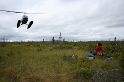
Helicopters are the only way to reach these remote bogs.
Evidence of an old burn at the bog edge.

The Canadian boreal peatland zone runs from eastern to western Canada. Going westward, climate becomes generally drier and the peatland vegetation cover changes from open Sphagnum bogs with shrubby hummocks and wet hollows in Quebec, to spruce-covered bogs in northern Alberta. Although forest fires are frequent in the entire Canadian boreal zone, peatlands are affected more frequently in western Canada because of the differences in vegetation cover. In the western part, peatlands have burned as frequently as the neighbouring uplands during the last couple of decades.


Fires directly release carbon to the atmosphere by combustion, but they also influence the functioning of the ecosystem in the long term. Fire and charcoal production alter the soil microclimate and microbial populations (e.g. testate amoebae) and therefore respiration dynamics. As fires may burn live vegetation and/or litter as well as peat, thecarbon balance of the peatlands is negatively influenced by recurrent fires. About 3 kg of carbon per metre squared can be released from a peat bog per fire in western Canada, which means that under the current climate conditions these bogs are only small net sinks of carbon. With ongoing climate change and more peat being burned, these bogs may even become net sources in the near future.
The situation is somewhat different in eastern Canada. During my Ph.D. research atUniversité du Québec à Montréal, I analysed peat cores from three open bogs from the Eastmain region in the heart of the spruce-dominated boreal forest, searching for evidence of peat burning and possible effects of varying fire regimes on peat carbon sequestration during the Holocene. In short, peat burns here too. However, peat fires are much less frequent than in western Canada and do not seem to affect the deeper peat. Therefore, fire has been a minor factor in the development of these peatlands, especially when compared to other external variables, of which Neoglacial cooling may have been the most important one.

A spectacular aerial view across the bogs in Quebec.

Charcoal from past burns in the peatland record.

A view across the bog in Quebec


Burning patterns can be highly variable at the ecosystem scale as well. In sites with micro-topographical features, hollows generally lose more organic matter by combustion than hummocks. The explanation for this lies in the nature of the hollow vegetation. During dry periods, hollows dry out much more rapidly than hummocks, because of the ‘loose’ nature of the Sphagnum species found here and their low potential for water retention, while the dense Sphagnum cover of hummocks retains humidity more effectively. Therefore, in these peatlands, hollows tend to burn more deeply.

Looking at the complex spatial and temporal patterns of peat fire occurrence, it may seem difficult to forecast peat fire regimes with ongoing climate change. In general, larger areas of forest will be affected and fire occurrence and fire season length are anticipated to increase for most of the Canadian boreal regions. One could argue that if forest fires become more frequent, peatlands too may burn more often. However, the sensitivity of peatlands to burning may not depend on the same meteorological variables that determine the sensitivity of forest stands. Alternatively perhaps, peatland vegetation, rather than weather, may be a critical factor. Either way, the fire regimes of boreal peatland regions are likely to become an increasingly important factor in the estimation of future carbon fluxes from natural sources.

Further reading:

de Groot, W.J., Flannigan, M.D., Cantin, A.S. (2013) Climate change impacts on future boreal fire regimes. Forest Ecology and Management 294: 35-44.

Turetsky, M., Wieder, K., Halsey, L., Vitt, D. (2002) Current disturbance and the diminishing peatland carbon sink. Geophysical Research Letters 29. doi:10.1029/2001GL014000.

Yu, Z. (2012) Northern peatland carbon stocks and dynamics: a review. Biogeosciences Discussions 9: 5073–5107

The worst U.S. mine fire, in Centralia, Pennsylvania, passed its 50-year mark last year. As coal-powered development spreads globally, so does the risk of underground fire.


The Centralia blaze, still burning more than 50 years after it began, ranks as the worst mine fire in the United States. But it is by no means the only one. More than 200 underground and surface coal fires are burning in 14 states, according to the U.S. Department of Interior's Office of Surface Mining Reclamation and Enforcement.

And with worldwide demand for coal surging, especially in industrializing nations such as India and China, mine fires have emerged as a global environmental and public health threat. Thousands of coal fires rage on every continent but Antarctica, endangering nearby communities. The blazes spew toxic substances such as benzene, hydrogen sulfide, mercury, and arsenic, as well as greenhouse gases like methane and carbon dioxide.

Final word from Sam Carana - 

Wildfires in the North threaten to cause large emissions of greenhouse gases and soot, which can settle on snow and ice in the Arctic and the Himalayan Plateau, with the resulting albedo changes causing a lot more sunlight to be absorbed, instead of reflected as was the case earlier. 

This in turn adds to the problem. 

Additionally, rising temperatures in the Arctic threaten to cause release of huge amounts of methane from sediments below the Arctic Ocean. 

This situation threatens to escalate into runway global warming in a matter of years
--SAM CARANA

The Threat of Wildfires in the North