Showing posts with label Gulf of Mexico. Show all posts

Wednesday, 17 July 2019

Is there evidence to indicate that climate engineering operations manipulated hurricane Barry?


Hurricane Barry And Toxic 

Algae Blooms, Is There A 

Connection?


GeoEngineering Watch

Is there evidence to indicate that climate engineering operations manipulated hurricane Barry? Available data makes clear the answer is yes. Is there evidence to indicate there are benevolent motives for such massive climate modification programs? Though the question of motives is complex, again, if all available data is examined, the agendas behind geoengineering programs must be considered to be primarily rooted to objectives of power and control. The six minute video below provides key information relating to these questions and conclusions.

Thursday, 11 July 2019

Meet hurricane Barry


Tracking Barry & Earthquake Report with Margo (July 10, 2019)


Existential threat to New 

Orleans this Weekend! - 

Mandatory Evacuation 

Orders Begin . . .


10 July, 2019

The weather situation in the Gulf of Mexico is weird and growing stranger by the hour.   It began when a low pressure system moved off land, SOUTH into the Gulf of Mexico from Georgia and Florida, where it began to muster strength from warm Gulf waters and grow in intensity.   Storms don't usually move south off land into the Gulf; normally they move north from the Gulf onto land.
Now drenching bands of rain are soaking areas from Florida to Louisiana and weather models are saying this could become a HURRICANE!
It began as a low pressure system called "Invest 92L" by the National Weather Service.   It has grown into Tropical Storm "Barry."
As of Wednesday afternoon at 3:45 PM eastern time, the storm is dumping huge amounts of rain and seems to be organizing itself into a Hurricane.
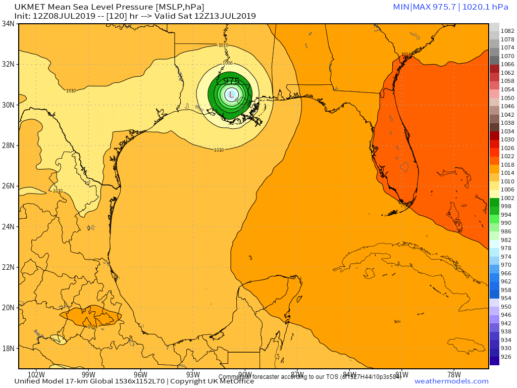
The UK Met computer model shows this:
The most recent visible satellite image shows this thing getting strong, fast:
Tropical Weather Outlook
NWS National Hurricane Center Miami FL
200 PM EDT Wed Jul 10 2019

For the North Atlantic...Caribbean Sea and the Gulf of Mexico:

The National Hurricane Center is issuing advisories on Potential
Tropical Cyclone Two, located over the northeastern Gulf of Mexico
less than 200 miles east-southeast of the mouth of the Mississippi
River.
* Formation chance through 48 hours...high...near 100 percent.
* Formation chance through 5 days...high...near 100 percent.

$$
Forecaster Stewart
"EXISTENTIAL THREAT FOR NEW ORLEANS"
One weather expert put it this way:
"Our general thinking remains that the most likely landfall location for the storm’s center will be somewhere between Galveston and New Orleans. Because heavy rainfall appears to be the primary threat, bar rapid intensification—which is not expected, but can’t be ruled out—the greatest impacts will be to the right of the storm’s landfall. Therefore the likelihood is that the worst effects of this storm, rainfall of 10 to 20 inches, remain for now east of Houston. However, until the center forms, we really cannot have particularly high confidence in such a prediction. Bottom line: If I lived in the greater Houston area, I’d be paying attention to forecasts, but I wouldn’t be freaking out at this time.

If the most likely scenario does play out, it will lead to significant problems for southern Louisiana, as parts of the New Orleans metro area have already received 10 inches or more of rainfall.
Levees in and around New Orleans are already dealing with massive amounts of water, and early reports are starting to come in that some of them are failing.  
MORE:
If the Mississippi River breaches the levee system designed to hold it on its present course, it would cripple America’s agricultural and petrochemical industries, deal a potentially fatal blow to New Orleans, and change the course of American history.
Said one government weather forecaster:
It's time to start grasping the reality of what Barry could do to New Orleans over the next 3-5 days. Lets start with Katrina. In 2005 prior to Katrina, the Mississippi river level was at 3 feet above sea level. A massive 13 foot storm surge brought the river to 16 feet.
Due to recent flooding, the MS river is already at 16 feet. A surge of 3-5 feet is expected from soon-to-be-Barry, bringing forecasted surge to 19-21 feet Saturday morning. The levees can handle surge up to 20 feet before failing.
This unfortunate series of events - an early-arriving tropical storm coming while the Mississippi river is already flooded - poses an existential threat to the entire city of New Orleans.
Now is the time to issue evacuation orders.  If the government waits much longer, it will be too late.
 NATIONAL HURRICANE CENTER CALLS IT: HURRICANE!
UPDATE 4:45 PM EDT --
..HURRICANE WATCH ISSUED FOR PORTIONS OF THE SOUTHERN COAST OF LOUISIANA... ...HEAVY RAINS EXPECTED TO CONTINUE ACROSS THE CENTRAL GULF COAST...

UPDATE 5:00 PM EDT --
Computer models now forecasting TWENTY-EIGHT POINT SEVEN INCHES OF RAIN!! ! ! !
 

UPDATE 5:20 PM EDT --
A MANDATORY EVACUATION ORDER has been issued for Plaquemines Parish shown on the map below:

UPDATE 6:40 PM EDT --
To give you an idea of how swollen the Mississippi River ALREADY IS, take a look at the video below from about 6:00 AM CENTRAL time this morning.   This video is taken from atop one of the levees  . . .  before the storm even arrives.   As you will quickly glean, there is no room for more rain, or more flooding or a storm surge.  It will over-top the levee within hours:

From Paul Beckwith


Step Right Up in the Climate Casino: New Orleans Looks to Be Next


Tuesday, 4 September 2018

Hurricane Gordon headed for US Gulf


3 September, 2018

 UPDATE 5:00 PM EDT MONDAY - HURRICANE "WARNING" NOW ISSUED, SEE BOTTOM

Tropical Storm Gordon just off the southwest tip of Florida is rapidly intensifying and is now expected to become a Hurricane overnight.  Computer models show landfall between Mobile, Alabama and New Orleans, Louisiana.
Persons in this area should prepare NOW for severe weather.   National Hurricane Center reports, maps and models appear below . . .
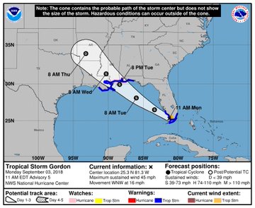
Monday Morning location off southwest Florida:


SUMMARY OF WATCHES AND WARNINGS IN EFFECT:


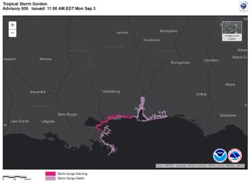
Storm Surge Warning is in effect for...
* Shell Beach to Mississippi-Alabama border


Storm Surge Watch is in effect for...
* West of Shell Beach to the Mouth of the Mississippi River
* East of the Mississippi-Alabama border to Navarre


Hurricane Watch is in effect for...
* Mouth of the Pearl River to the Alabama-Florida Border


Tropical Storm Warning is in effect for...
* Golden Beach to Bonita Beach
* Craig Key to Ocean Reef, including Florida Bay
* Okaloosa-Walton County Line westward to east of Morgan City,
Louisiana, including Lake Pontchartrain and Lake Maurepas


Storm Surge Warning means there is a danger of life-threatening
inundation, from rising water moving inland from the coastline,
during the next 36 hours in the indicated locations. For a
depiction of areas at risk, please see the National Weather
Service Storm Surge Watch/Warning Graphic, available at
hurricanes.gov. This is a life-threatening situation. Persons
located within these areas should take all necessary actions to
protect life and property from rising water and the potential for
other dangerous conditions. Promptly follow evacuation and other
instructions from local officials.


A Storm Surge Watch means there is a possibility of life-
threatening inundation, from rising water moving inland from the
coastline, in the indicated locations.


A Hurricane Watch means that hurricane conditions are possible
within the watch area. A watch is typically issued 48 hours
before the anticipated first occurrence of tropical-storm-force
winds, conditions that make outside preparations difficult or
dangerous.


A Tropical Storm Warning means that tropical storm conditions are
expected somewhere within the warning areas.


For storm information specific to your area, including possible
inland watches and warnings, please monitor products issued by your
local National Weather Service forecast office.


DISCUSSION AND OUTLOOK
----------------------
At 200 PM EDT (1800 UTC), the center of Tropical Storm Gordon was
located near latitude 25.8 North, longitude 81.9 West. Gordon is
moving toward the west-northwest near 16 mph (26 km/h) and a west-
northwestward to northwestward motion is expected over the next
72 hours. On the forecast track, the center of Gordon will move
farther away from the southwestern coast of Florida this
afternoon and move across the eastern Gulf of Mexico tonight and
Tuesday. The center of Gordon will approach the coast within
the warning area along the central Gulf Coast by late Tuesday or
Tuesday night, and move inland over the lower Mississippi Valley on
Wednesday.


Maximum sustained winds have increased to near 50 mph (85 km/h) with
higher gusts. Additional strengthening is forecast during the next
36 hours, and Gordon is expected to be near hurricane strength when
it makes landfall along the central Gulf Coast.


Tropical-storm-force winds extend outward up to 45 miles (75 km)
from the center.


The estimated minimum central pressure is 1007 mb (29.74 inches).


HAZARDS AFFECTING LAND
----------------------
STORM SURGE: The combination of a dangerous storm surge and the
tide will cause normally dry areas near the coast to be flooded by
rising waters moving inland from the shoreline. The water could
reach the following heights above ground somewhere in the indicated
areas if the peak surge occurs at the time of high tide...


Shell Beach to the Mississippi-Alabama border...3 to 5 ft.
Navarre Florida to the Mississippi-Alabama border...2 to 4 ft.
Shell Beach to the Mouth of Mississippi River...2 to 4 ft.
Mouth of the Mississippi River to the Louisiana-Texas border...1 to
2 ft.


The deepest water will occur along the immediate coast near and to
the east of the landfall location, where the surge will be
accompanied by large waves. Surge-related flooding depends on the
relative timing of the surge and the tidal cycle, and can vary
greatly over short distances. For information specific to your area,
please see products issued by your local National Weather Service
forecast office.


RAINFALL: Gordon is expected to produce total rain accumulations of
2 to 4 inches over the central and northwestern Bahamas, the Florida
Keys, and South Florida through early Tuesday. Isolated maximum
amounts of 8 inches are possible over the southern Florida
peninsula.


Gordon is expected to produce total rain accumulations of 4 to 6
inches over southern Alabama, southern Mississippi and Louisiana,
with isolated maximum amounts of 8 inches through early Thursday.


These rainfall amounts may cause flash flooding.


WIND: Tropical storm conditions will continue through this
afternoon in the warning areas across South Florida and the Florida
Keys. Tropical storm conditions are expected within portions of the
central Gulf Coast warning area by late Tuesday, with hurricane
conditions possible late Tuesday or Tuesday night in the hurricane
watch area.


TORNADOES: A couple of tornadoes are possible through tonight
across the southern and west-central Florida Peninsula.


NEXT ADVISORY
-------------
Next complete advisory at 500 PM EDT.

$$
Forecaster Stewart


View image on TwitterView image on Twitter

A Hurricane Watch has been issued for the and coastlines, and a Storm Surge Warning has been issued for the Mississippi and portions of the Louisiana coastlines.

This means storm surge inundation of up to 5 ft above dry ground and winds >75mph are possible.

EVACUATIONS

"A voluntary evacuation was issued in Grand Isle on Monday, Sept. 3, 2018 while that area remains in a Tropical Storm Warning from Tropical Storm Gordon."


SATELLITE


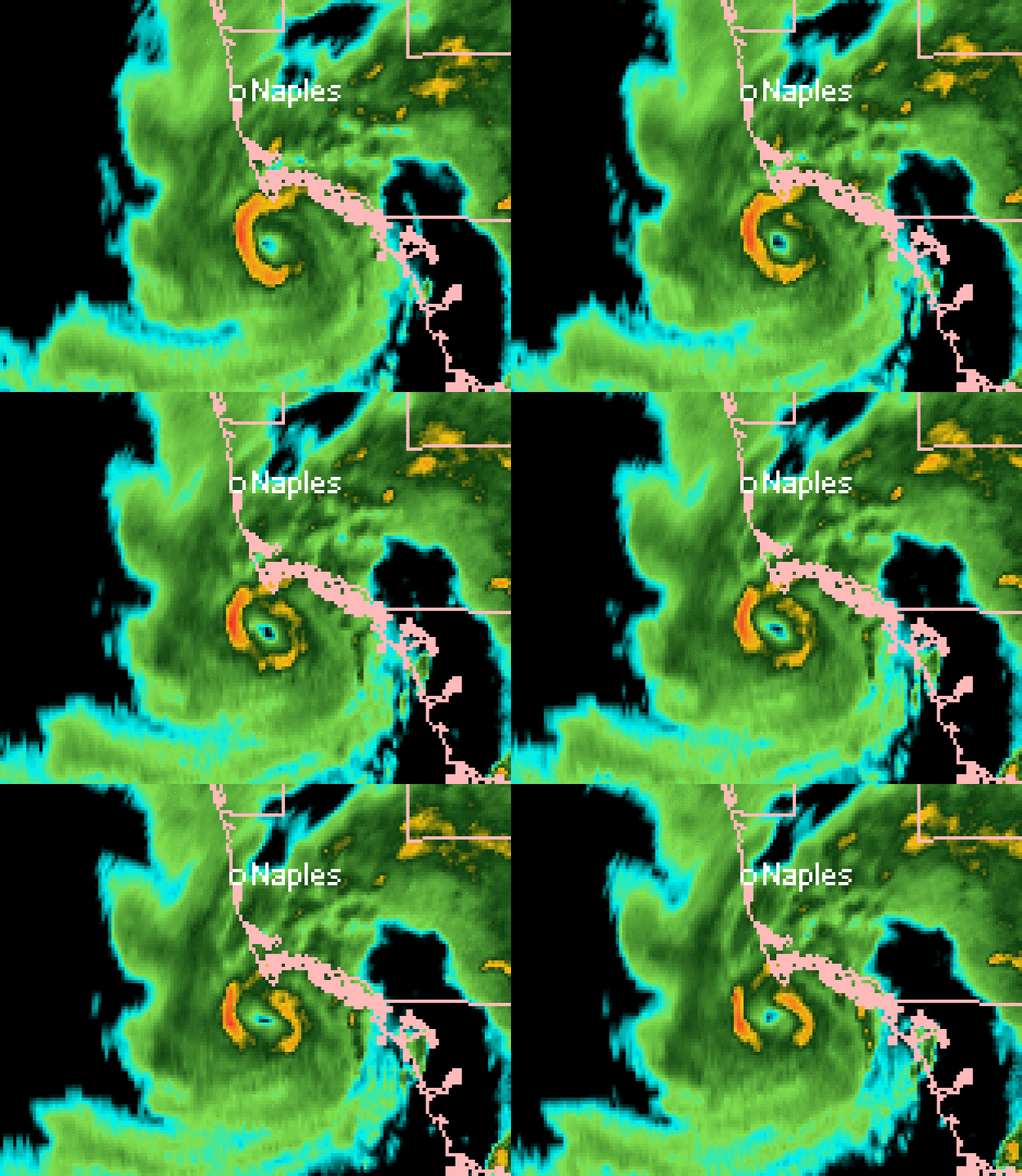
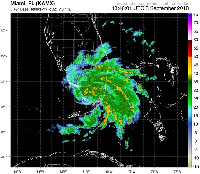
The center of Tropical Storm will soon emerge over the Gulf of Mexico off of the Everglades.

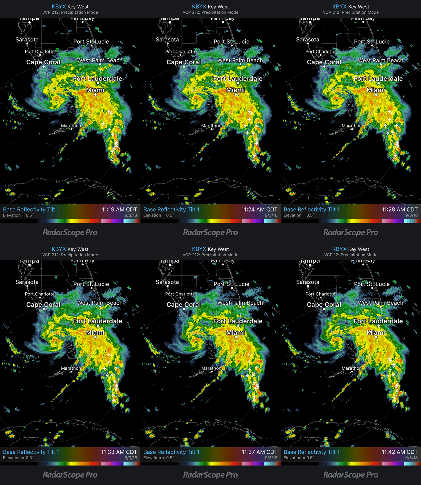
Radar loop from @nissenwx: http://moe.met.fsu.edu/~mnissenbaum/radar 

UPDATE 5:00 PM EDT MONDAY --

*** HURRICANE WARNING ISSUED ***


442 
WTNT32 KNHC 032038
TCPAT2

BULLETIN
Tropical Storm Gordon Advisory Number   6
NWS National Hurricane Center Miami FL       AL072018
500 PM EDT Mon Sep 03 2018

...HURRICANE WARNING ISSUED FOR PORTIONS OF THE CENTRAL GULF
COAST AND STORM SURGE WARNING EXTENDED EASTWARD...


SUMMARY OF 500 PM EDT...2100 UTC...INFORMATION
----------------------------------------------
LOCATION...26.2N 82.6W
ABOUT 50 MI...85 KM WSW OF FT. MYERS FLORIDA
ABOUT 445 MI...715 KM ESE OF THE MOUTH OF THE MISSISSIPPI RIVER
MAXIMUM SUSTAINED WINDS...50 MPH...85 KM/H
PRESENT MOVEMENT...WNW OR 300 DEGREES AT 17 MPH...28 KM/H
MINIMUM CENTRAL PRESSURE...1006 MB...29.71 INCHES


WATCHES AND WARNINGS
--------------------
CHANGES WITH THIS ADVISORY:

The Storm Surge Warning has been extended eastward to Dauphin
Island, Alabama.

A Hurricane Warning has been issued from the Mouth of the Pearl
River to the Alabama-Florida Border. This warning replaces the
Hurricane Watch and Tropical Storm Warning for this area.

The Tropical Storm Warning for the Upper Florida Keys and from
Golden Beach to Chokoloskee, including Florida Bay, has been
discontinued.

SUMMARY OF WATCHES AND WARNINGS IN EFFECT:

A Storm Surge Warning is in effect for...
* Shell Beach to Dauphin Island

A Storm Surge Watch is in effect for...
* West of Shell Beach to the Mouth of the Mississippi River
* East of Dauphin Island to Navarre

A Hurricane Warning is in effect for...
* Mouth of the Pearl River to the Alabama-Florida Border

A Tropical Storm Warning is in effect for...
* Chokoloskee to Bonita Beach
* West of the Mouth of the Pearl River to east of Morgan City,
Louisiana, including Lake Pontchartrain and Lake Maurepas
* Alabama-Florida Border to Okaloosa-Walton County Line

A Storm Surge Warning means there is a danger of life-threatening
inundation, from rising water moving inland from the coastline,
in the indicated locations. For a depiction of areas at risk, please
see the National Weather Service Storm Surge Watch/Warning Graphic,
available at hurricanes.gov. This is a life-threatening situation.
Persons located within these areas should take all necessary actions
to protect life and property from rising water and the potential for
other dangerous conditions. Promptly follow evacuation and other
instructions from local officials.

A Storm Surge Watch means there is a possibility of life-
threatening inundation, from rising water moving inland from the
coastline, in the indicated locations.

A Hurricane Warning means that hurricane conditions are expected
somewhere within the warning area. Preparations to protect life
and property should be rushed to completion.

A Tropical Storm Warning means that tropical storm conditions are
expected somewhere within the warning areas.

For storm information specific to your area, including possible
inland watches and warnings, please monitor products issued by your
local National Weather Service forecast office.


DISCUSSION AND OUTLOOK
----------------------
At 500 PM EDT (2100 UTC), the center of Tropical Storm Gordon was
located by NOAA Doppler weather radars near latitude 26.2 North,
longitude 82.6 West. Gordon is moving toward the west-northwest near
17 mph (28 km/h) and a west-northwestward to northwestward motion is
expected over the next 72 hours.  On the forecast track, the center
of Gordon will move farther away from the southwestern coast of
Florida early this evening, and move across the eastern Gulf of
Mexico tonight and Tuesday. The center of Gordon will approach the
central Gulf Coast within the warning area late Tuesday or Tuesday
night, and move inland over the lower Mississippi Valley on
Wednesday.

Maximum sustained winds are near 50 mph (85 km/h) with higher gusts.
Gradual strengthening is forecast during the next 36 hours, and
Gordon is expected to be a hurricane when it makes landfall along
the central Gulf Coast.

Tropical-storm-force winds extend outward up to 45 miles (75 km)
from the center.

The estimated minimum central pressure is 1006 mb (29.71 inches)
based on earlier reports from an Air Force Reserve reconnaissance
aircraft.


HAZARDS AFFECTING LAND
----------------------
STORM SURGE:  The combination of a dangerous storm surge and the
tide will cause normally dry areas near the coast to be flooded by
rising waters moving inland from the shoreline. The water could
reach the following heights above ground somewhere in the indicated
areas if the peak surge occurs at the time of high tide...

Shell Beach to Dauphin Island, Alabama...3 to 5 ft.
Navarre Florida to Dauphin Island, including Mobile Bay...2 to 4 ft.
Shell Beach to the Mouth of Mississippi River...2 to 4 ft.
Mouth of the Mississippi River to the Louisiana-Texas border...1 to
2 ft.

The deepest water will occur along the immediate coast near and to
the east of the landfall location, where the surge will be
accompanied by large waves. Surge-related flooding depends on the
relative timing of the surge and the tidal cycle, and can vary
greatly over short distances. For information specific to your area,
please see products issued by your local National Weather Service
forecast office.

RAINFALL:  Gordon is expected to produce total rain accumulations of
2 to 4 inches over the northwestern Bahamas, Florida Keys, and South
Florida through early Tuesday. Isolated maximum amounts of 8 inches
are possible over the southern Florida peninsula.

Gordon is expected to produce total rain accumulations of 4 to 6
inches over southern Alabama, southern and central Mississippi, and
southeastern and northeastern Louisiana, with isolated maximum
amounts of 8 inches through late Thursday.

These rainfall amounts may cause flash flooding.

WIND:  Tropical storm conditions will continue for the next few
hours in the warning area across southwestern Florida. Tropical
storm conditions are expected within portions of the central Gulf
Coast warning area by late Tuesday, with hurricane conditions
expected late Tuesday or Tuesday night in the hurricane warning
area.

TORNADOES:  A couple of tornadoes are possible through tonight
across the southern and west-central Florida Peninsula.


NEXT ADVISORY
-------------
Next intermediate advisory at 800 PM EDT.
Next complete advisory at 1100 PM EDT.

$$
Forecaster Stewart