

***BULLETIN*** "Laura" Heading toward Cat. 5 - TWENTY FOOT storm surge EVACUATE COASTAL Louisiana Near Lake Charles and Coastal Texas Near Beaumont (LIVE UPDATES)

LAST UPDATED 6:09 PM EDT -- Hurricane Laura is strengthening at an unprecedented rate.
Expected to reach Category 5 before landfall.
Sustained winds now 125 MPH and strengthening.
National Weather Service now predicting upwards of twenty four inches of rain within 24 hours around landfall area.
National Hurricane Center predicting twenty-foot storm surge above ground, up to eight miles inland.
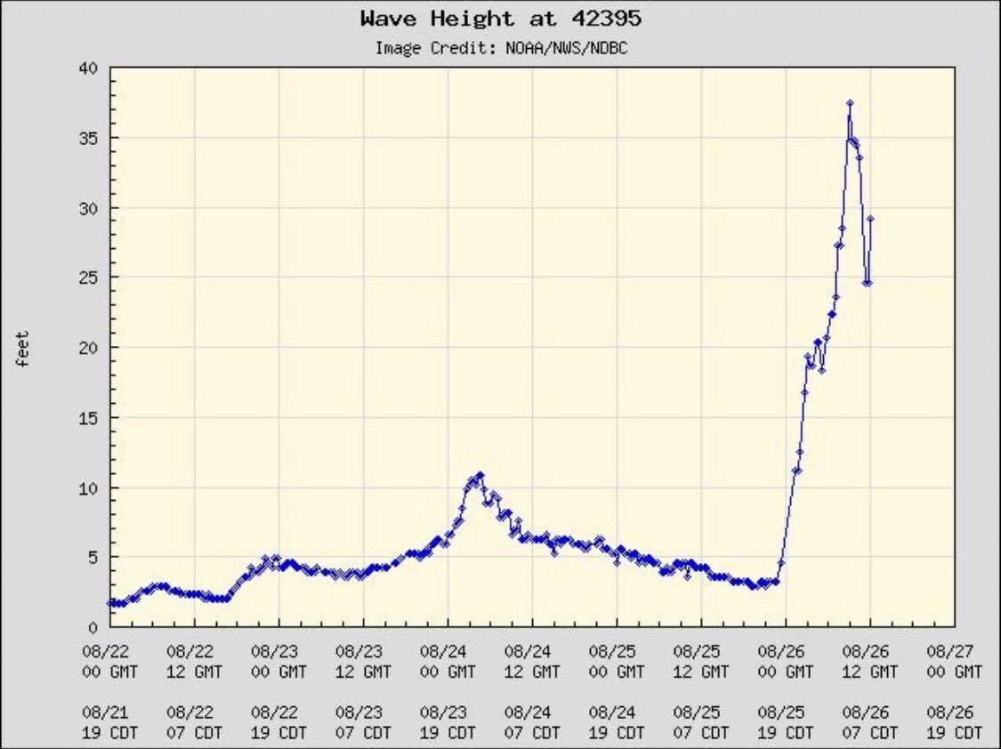
As of this morning, WAVE HEIGHTS in the gulf are reaching almost FORTY FEET:
Computer model shows ground "inundation" below:

UK Weather calls this storm strengthening "Jaw-dropping."
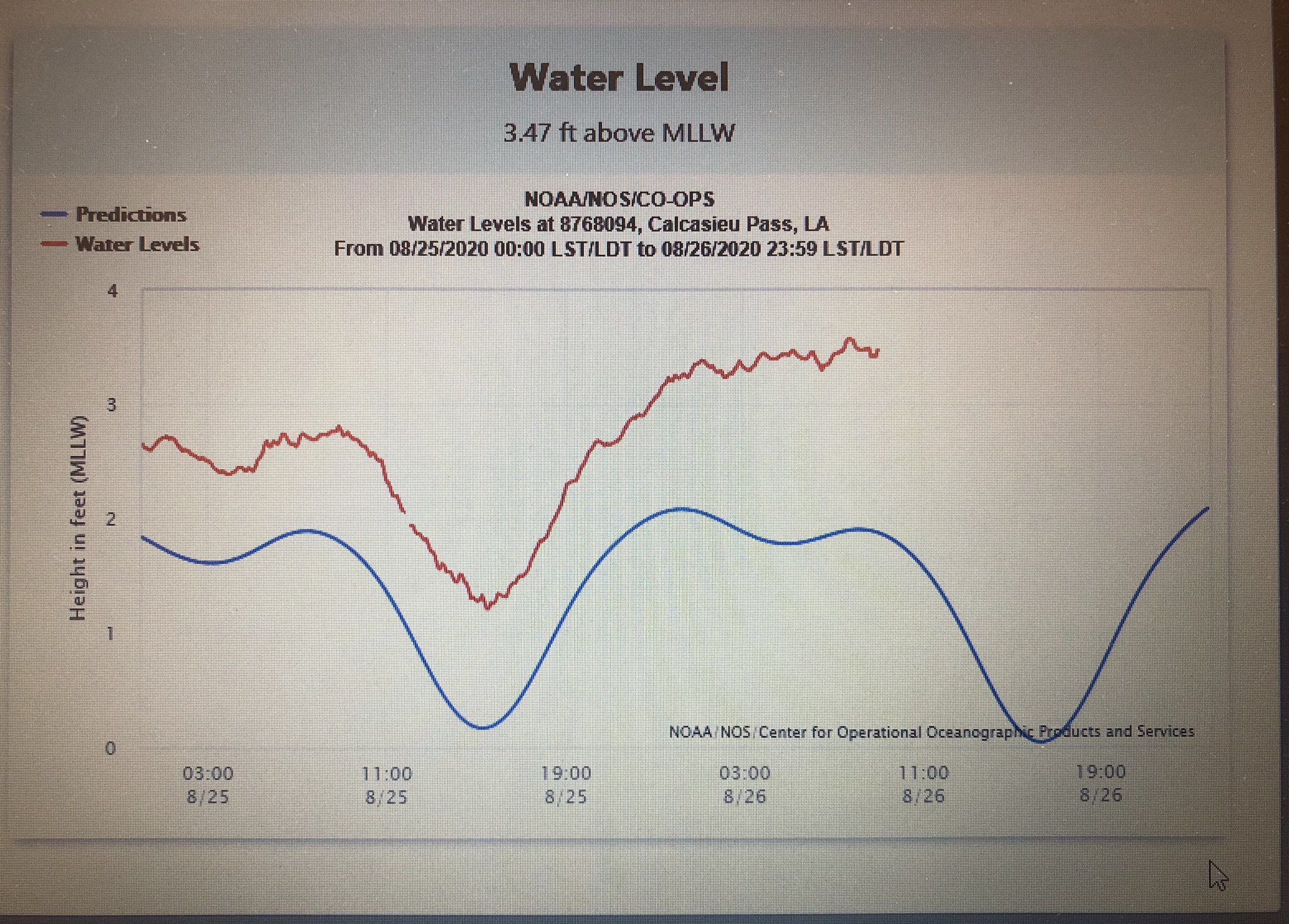
Water level gauges in Louisiana are already showing storm surge HIGHER THAN EXPECTED for this hour:
If you are on the Louisiana coastline, you should EVACUATE NOW. RIGHT NOW!
Official readings as of 11:00 AM Eastern US time (10:00 Central US Time):
10:00 AM CDT Wed Aug 26
Location: 27.0°N 92.0°W
Moving: NW at 16 mph
Min pressure: 956 mb
Max sustained: 125 mph
NATIONAL HURRICANE CENTER LATEST BULLETIN:
"Unsurvivable storm surge,large & destructive waves will cause catastrophic damage from Sea Rim State Park,TX,to Intracoastal City,LA, This surge could penetrate up to 30 miles inland"

In Louisiana, Storm Surge beginning well in advance of storm arrival:
UPDATE 6:09 PM EDT --
NHC updated info: Unsurvivable storm surge with large and destructive waves will cause catastrophic damage from Sea Rim State Park, Texas, to IntracoastalCity, Louisiana, including Calcasieu and Sabine Lakes. This surge could penetrate up to 40 miles inland from the immediate coastline, and flood waters will not fully recede for several days after the storm.
LOCAL OFFICIALS: Big swathes of I-10 going to be underwater. Get out now
No comments:
Post a Comment
Note: only a member of this blog may post a comment.