Harvey’s Flooding Already Catastrophic and Another 2-3 Feet of Rainfall is on the Way
27 August, 2017
For Houston, a city that hosts a massive oil industry, it’s the climate change related flood version of the Fort McMurray fire. And we may well be witnessing, at this time, a tragedy that we could have at least in part prevented, but didn’t.
*****
Last
week at this time, meteorologists
were tracking a tropical cyclone moving across the Caribbean.
5-7 day models indicated that the system would enter the Gulf of
Mexico by late week. This Gulf was hotter than normal. And for the
past three months it had been dumping an over-abundance of moisture
into an unusually deep summer trough over the Eastern U.S. This
interaction between two features related to human-forced climate
change was already producing
very severe thunderstorms that generated record rainfall over places
like Kansas City, Missouri.
Harvey
was very moisture rich. It issued from a tropical
convergence zone and monsoon cycle that had hit unusually high
intensity —
due, at least in part, to abnormally warm ocean surface waters
injecting much higher than normal moisture loads into the tropical
atmosphere. And early last week there was some
serious concern that intense tropical moisture in the form of Harvey
could combine with a Gulf and Eastern U.S. weather and climate
pattern that had already produced unprecedented rains to generate
ultimately catastrophic results.
These
fears have now been realized.
As
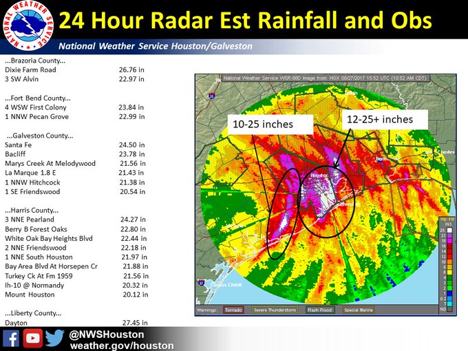
of this afternoon, parts of Houston
and Southeast Texas had received more than 30 inches of rainfall —
with up to 26
inches falling in just one 24-hour-period.
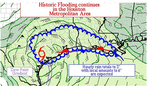
Hourly rainfall rates at times have hit an equally unprecedented rate
of up to six inches per hour. For context, one inch per hour rainfall
rates in the past have been considered extreme. Six inches per hour
is just off the charts. In many places, the most rain ever to fall
over a one day time-frame was breached.
As
we have seen so often around the world from
globally increasing instances of record rainfall,
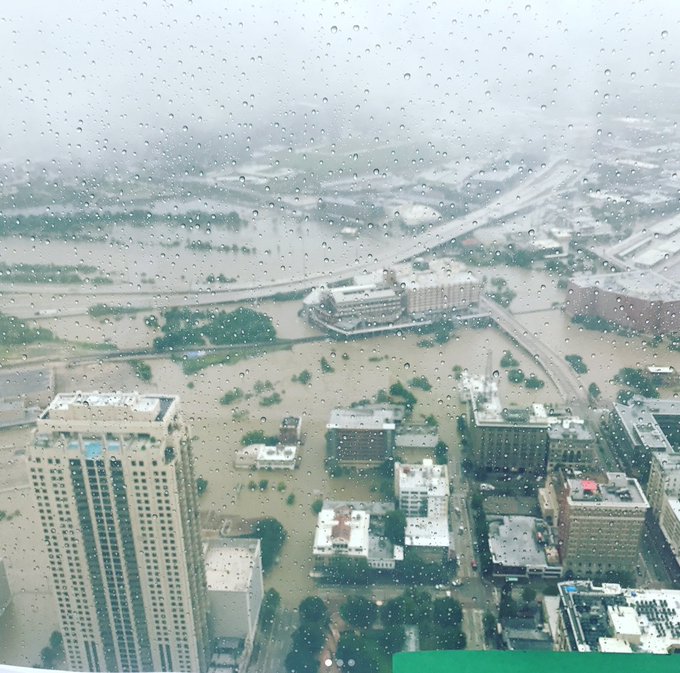
roads flooded, cars were abandoned, and people were forced to climb
onto their rooftops to flee the rising waters. In a Houston that is
increasingly looking like post-Katrina New Orleans, more than 1,000
emergency calls for water rescues had been received by this morning.
And with rivers hitting never-before-seen heights in a flood-prone
city that is also facing the effect of rising sea levels, the rains
were showing little sign of abating.
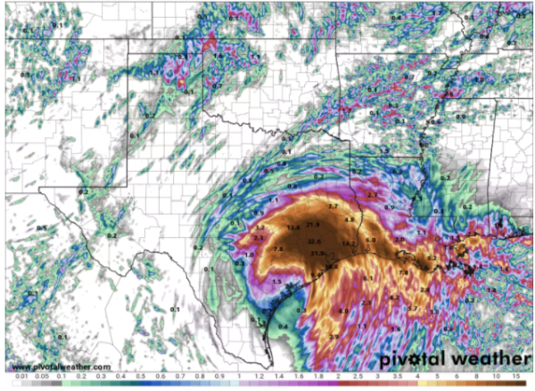
(Pivotal weather shows up to 32 inches of additional rainfall for the Houston region through Tuesday. The storm, however, may last through Thursday or later. Image source: Pivotal Weather.)
As
much as 1-3 feet of additional rain is still expected from the storm.
In the worst case, this would bring ultimate rainfall totals to
50-60+ inches. In a litany that we are hearing practically everywhere
now — this would be the worst rainfall event Texas has ever seen in
our records. It might, ultimately, be the worst flood from rainfall
the U.S. has ever seen.
Moreover,
weather models now indicate that Harvey may slowly track back toward
the Gulf of Mexico. If this happens, a storm that is already pulling
severe volumes of moisture in from the Gulf could be somewhat
re-invigorated. Such a result would bring a second pulse of intense
rains to parts of Southeast Texas and possibly Louisiana.
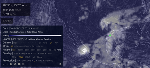
(September
1 GFS model shows remnants of Harvey interacting with a tropical
cyclone south of Baja to continue to pull rains over Texas and
Louisiana. Image source: Earth Nullschool.)
An
additional concern is the fact that later this week Harvey shows a
possible interaction with another stationary tropical cyclone forming
near the southern tip of Baja in the Pacific. The two storms appear
to interact to draw still more moisture from the abnormally warm Gulf
over Southeast Texas later this week. Of course, this GFS-based
forecast is still longer range — and therefore less certain. But
the models do seem to continue to indicate a persistent heavy
rainfall potential for an already catastrophically flooded region
over an unprecedented long time frame.
This
is exactly the kind of extreme rainfall event that some of us have
feared coming from a warmer, more moisture-rich atmosphere in which
weather systems have tended, more and more often, to persist and
produce long-lasting effects. For the sake of all involved, we are
now reduced to prayers and hopes that the worst case does not
continue to be realized.
(UPDATED
9)
Links:
Hat tip to Greg
Hat tip to eleggua


No comments:
Post a Comment
Note: only a member of this blog may post a comment.