

One
picture is worth a thousand words.How much is a dozen photos worth?
As has been pointed out all the old, multi-year ice is being pushed down to Greenland and the Canadian Arctic while the remainder of thin ice is being fractured and being pushed around by ocean curents and wind.

The
denialists are getting desperate.
I
had a comment today from one saying that the 2012 melt exceeded this
year's.
Apart
from the claim to being psychic it's amazing that this denier has to
resort to comparison with the lowest sea ice extent on record.
What
these idiots can't recognise is that the situation is very different
in that there is very little multi-year ice left and ice in proximity
to the Pole is fracturing and subject to ocean currents and winds
that are affecting the area as we speak.
Whilst
it takes a lot of heat to melt the ice once we get to this stage it
doesn't really matter.
Barring
miracles it doesn't really matter if there is a blue sea event or
not. The ice has gone.
Does
it matter that we end up with 2 mln sq km of ice instead of 1?
The
writing is on the wall and the disappeared multi-year ice is never
coming back (barring their favourite fable, a sudden ice age).
Extreme
ice on Canada's east coast – in pictures
Warming
temperatures caused perilous ice up to eight metres thick to drift
south from the Arctic to clog the coasts of Newfoundland, Labrador
and Quebec. It trapped boats and ferries as late as June, with
Canadian scientists blaming climate change. These dramatic photos
capture the rare event.
All
photographs by Louis Helbig unless otherwise credited

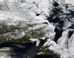
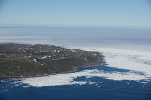
A
satellite view of the coast of Newfoundland and the estuary of the St
Laurent river on 26 May. Ice can be seen along the coast. Red dots
are locations where the following pictures were taken
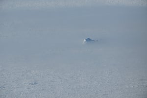
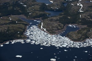
An
iceberg in pack ice and shrouded in fog in Alexis Bay, Labrador.
Scientists said the unseasonal thick, dense ice was multi-year ice
that had travelled down from the high
Arctic.
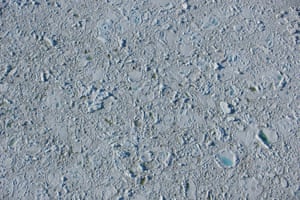
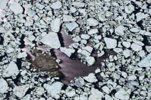
Solid pack ice in Petty Harbour, Labrador. This type of ice had never been seen before in the area. Chunks measured between 5m and 8m thick.
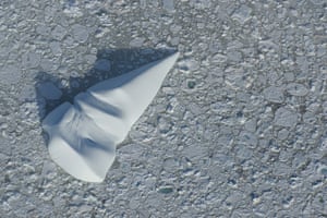
Broken
icebergs can travel long distances on ocean currents. This pack ice
in the Strait of Belle Isles would have made its way from the high
Arctic.
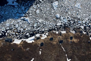
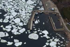
Buildings
in Murray Harbour, Labrador show the scale of the ice. Murray Harbour
is one of many largely abandoned outports along the Labrador coast
that now sees only seasonal visits from former residents.
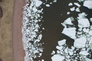
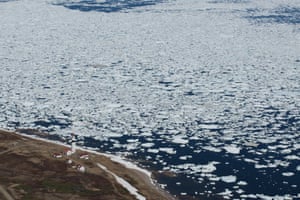
Melting
pack ice crowds into a beach on a cove near L’Anse-au-Loup,
Labrador
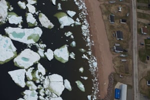
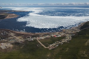
Buildings
in L’Anse-au-Loup look out over the pack ice flow.
Fishing
boats at L’Anse-au-Loup blocked by pack ice.
Pack
ice flowed south from Labrador to blockade La Tabatière, Quebec
La
Baleine, Quebec, was the southernmost community to be blockaded.
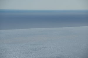
Pack
ice in Strait of Belle Isle near Blanc-Sablon.
No comments:
Post a Comment
Note: only a member of this blog may post a comment.