

Some
kind of " event" has taken place in Uummannaq Bay Greenland
after a sustained period of high anomaly weather.
Robin Westenra and
Sam Carana have been posting lately about temperatures above zero and
rain in the Arctic in the winter for pitys sake!
Could
it be a methane discharge that has disturbed the ice from below?
I'm
only speculating but whatever it was events like this in the Arctic
are always bad news.
Brace
for imminent impact.
---Kevin Hester
What
is Up in Disko-Uummannaq Bay Greenland January 9-16, 2016
Posted
by Mauri Pelto
17
January, 2016
@TenneyNaumer
contacted Alun Hubbard, Jason Box and I with an astute observation
last evening. “But what I am getting at is that in general the
temperature anomalies over the region of Jakobshavn have been high in
the last few days, and I spotted weird temperatures off the coast via
Climate Reanalyzer (which is seriously low resolution). I just
checked with the manati satellite (also seriously low resolution),
and it seems some sort of event has taken place.”
Following
up on what are typically good observations from Tenney I looked at
the Radarsat-2 and Sentinel-1 imagery posted by the Danish
Meteorological Institute.
Weather records from automatic weather stations in the region
from PROMICE and
the surface mass balance model results for the week from Polar
Portal.
It
is evident from the PROMICE weather records on the ice sheet just
south of the Disko Bay region that temperatures have been
exceptionally high since January 5th and atmospheric pressures have
been high since January 9th. The Polar Portal mass balance
model indicates some actual declines/ablation in the last week. This
is more likely sublimation from foehn conditions than actual melt.
The real changes are in the sea ice fronts and ice in the
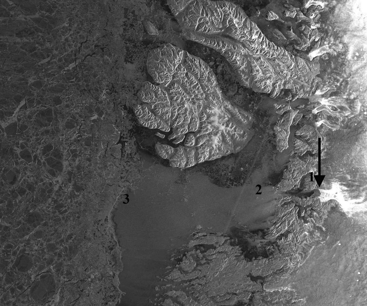
coastal inlets illustrated by MODIS. Below are images from January 9,
11, 13 and 16 for Disko Bay and January 9, 13 and 16 from Uummannaq
Bay.
The
arrow at location 1# is an area of sea ice across the fjord in front
of Jakobshavn Glacier on January 9, that disappears by January 13.
Location #2 is at the fjord mouth and location #3 is at the sea front
south of Disko Island on January 9. There is no real cloud
cover evident in any of images. Maybe low level fog in places.
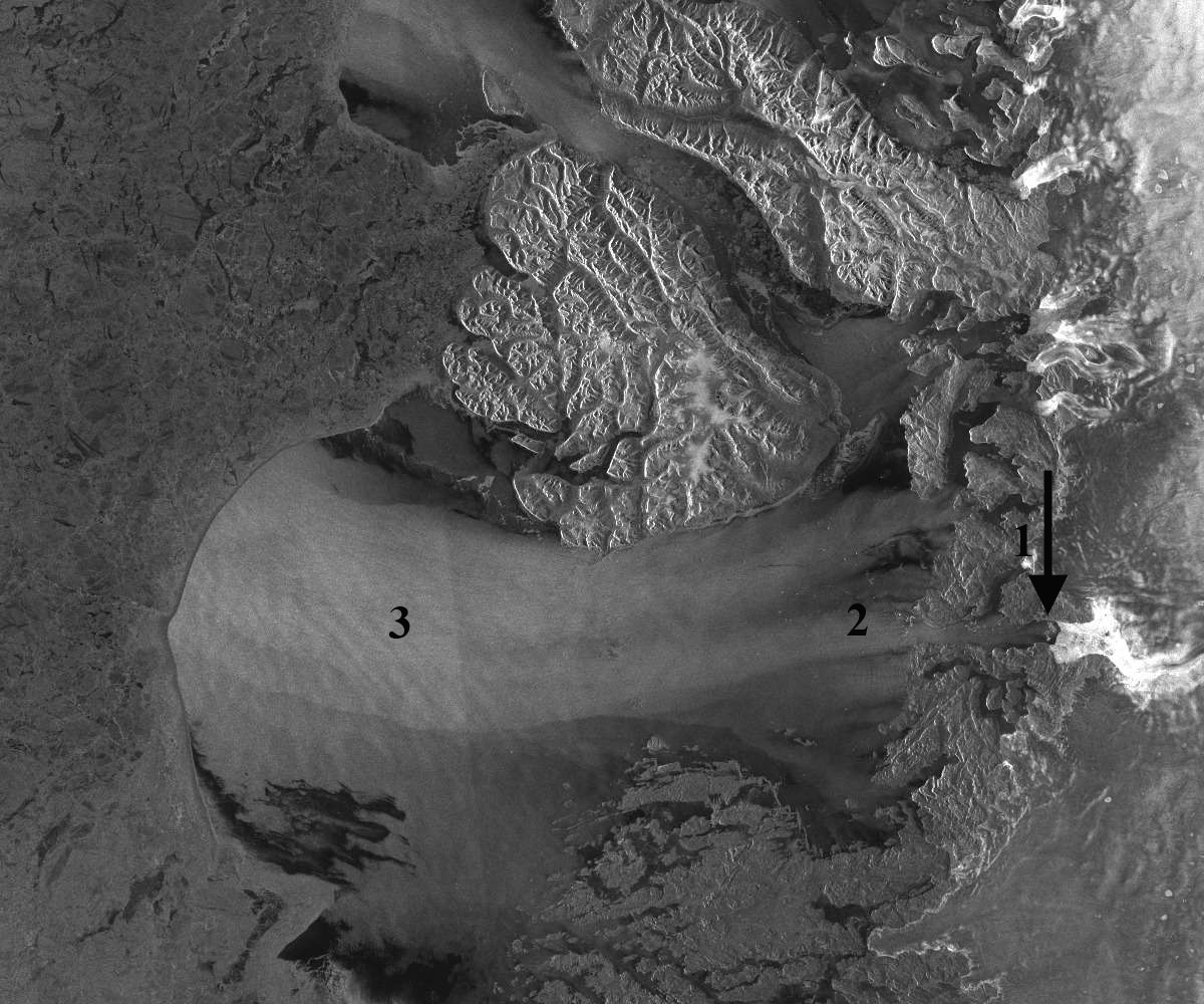
By January 11th a plume is sweeping from Point 2 towards Point 3.
Notice the sea ice in the fjord disappears by January 13th and the
ice front is pushed back in a concave fashion at Point #3. This
indicates a clear push of water driving sea ice offshore. The
Ilulissat Fjord mouth lack of ice is also evident in Webcam
images from
1-16-16 and 1-17-16 at the Hotel Arctic, last images below with two
boats plying the open water. on the 16th and icebergs clogging the
fjord mouth on the 17th. The Sentinel-1 image from January
16th shows a significant flushing of icebergs from Ilulissat Fjord,
pointed out by black arrows. This image has better clarity and
with the icebergs scattered through the plume, indicate more clearly
the plume is a water source change event, even if wind driven. The
iceberg plume in the fjord has a brighter aspect due to the varied
surface aspect-reflectance and has expanded down fjord. The
event must be due to or enhanced by strong offshore winds
and @ruth_mottram indicates there was at least one foehn event.
The plume indicates the ice melange in front of Jakobshavn has been
largely removed.
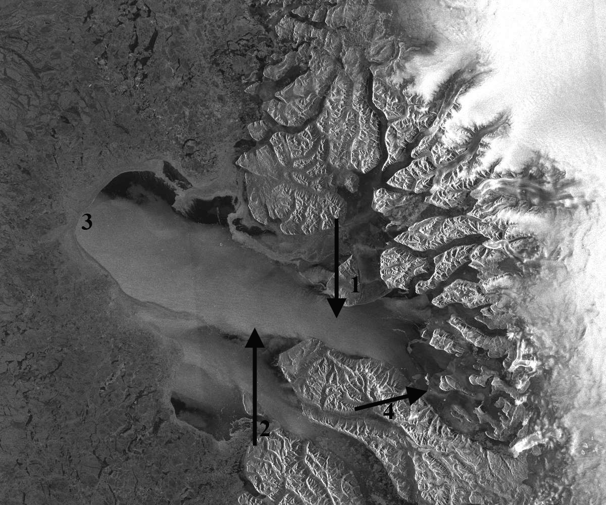
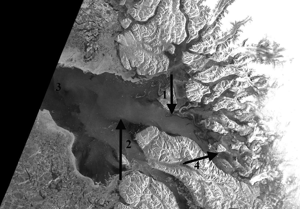
In
Uummannaq Bay a very similar sequence plays out, note on January 9
the sea ice connecting islands near #4. By January 13th the ice
at location #4 is gone. The ice front is now at location #3,
which on January 9th was well into the ice pack. Again we have
a clear push of water leading to a concave sea ice front that is
pushed well offshore. Icebergs can be seen amidst plume on January
16th, the plume opacity and size has diminished since January 13h.
In
both of the January 13th images there is a plume leading to the
concave sea ice front, the question being is this sediment laden
water, with the resultant higher reflectivity or is it a combination
of a surface water change from wind or a combination. Jason Box
suggests it is aeration of the surface water from the strong offshore
winds. The ice must in part be driven back by a surface water push.
You can see icebergs in sections of the plumes closer to shore
suggesting this is a surface near surface phenomenon. This is a short
term event. However, it could have broader implications, Moon
et al (2015) indicate
the importance of a rigid ice melange at the front of tidewater
outlet glaciers in Greenland. In this case the ice melange in
front of Jakobshavn has been removed, and probably from in front of
other glaciers. I look forward to further insights from the
community.

RADARSAT-2
IMAGE FROM Disko Bay 1/09/2016
RADARSAT-2
IMAGE FROM Disko Bay 1/11/2016
RADARSAT-2
IMAGE FROM Disko Bay 1/13/2016
Sentinel-1
imagery from 1-16-16 of Disko Bay-notice expanded brightness area in
the fjord by #1.

Sentinel
1 imagery of Uummannaq Bay 1/09/2016
RADARSAT-2
IMAGE FROM Uummannaq Bay MODIS 1/13/2016
Sentinel
1 imagery of Uummannaq Bay 1/13/2016 plume size and opacity
diminishing.
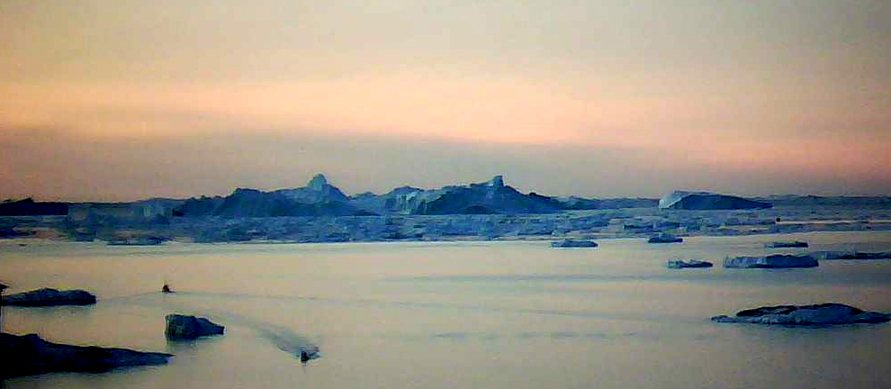
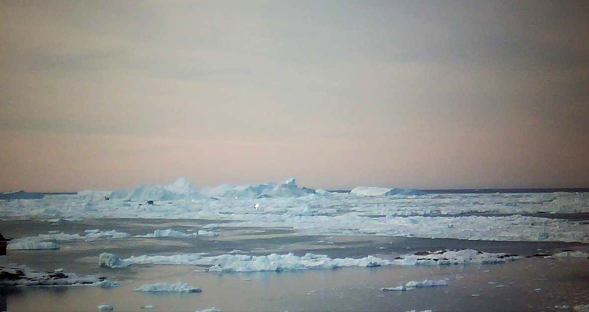
Ilulissat
Fjord mouth webcam view 1-16-16.
Ilulissat
Fjord mouth webcam view 1-17-16.
No comments:
Post a Comment
Note: only a member of this blog may post a comment.